Geomythology: The Beast of Gévaudan

On the last day of June 1764, the 14-year-old Jeanne Boulet was killed near the village of Saint-Étienne-de-Lugdarès, at the time located in the county of Gévaudan, a highland region in the middle of southern France. Only some remains of the young shepherdess were ever recovered. Just a month later, a 15-year-old girl was attacked near Puylaurent. Deadly wounded, she managed with her last breath to describe the attacker as “a horrible beast.”

Animal attacks were common at the time. However, now authorities started to note an unsettling pattern. Already on September 8, 1762, a boy from the village of Laval was killed by an unknown creature. One month before Jeanne Boulet, another shepherdess was attacked near the city of Saint-Flour in the Auvergne. Her herd formed a defensive ring against the attacker, saving the girl in the end. Notable enough, the creature seemed to be less interested in the cattle than in the girl. And now, more and more children and women were killed by the unknown creature – the Beast of Gèvaudan.

“Figure of the ferocious Beast”, one of the first depictions of the Beast published in November 1764.

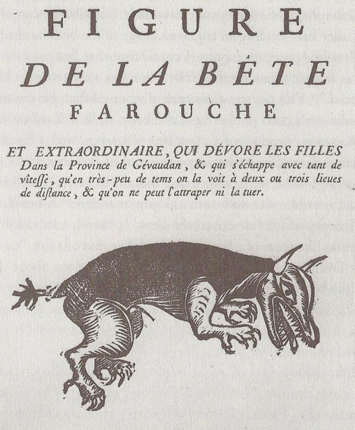
Overwhelmed by the developing disaster, authorities asked for military support. Jean-Baptiste Duhamel, the captain of the local infantry, organized a hunt involving, as he claims, 30.000 men. But even as the Beast was finally spotted and shot, it escaped unharmed by the bullets into the woods. A local newspaper wrote at the end of the first year:

» … a ferocious beast of unknown type, coming from who knows where, attacks the human species, killing individuals, drinking their blood, feasting on their flesh, and multiplying its carnage from day to day…hunters who are in pursuit have neither been able to stop it, because it is more agile than they, nor lure it into their traps, because it surpasses them in cunning, nor engage in combat when it presents itself to them, because its terrifying appearance weakens their courage, disturbs their vision, sets their hands shaking, and neutralizes their skill. «

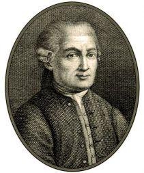
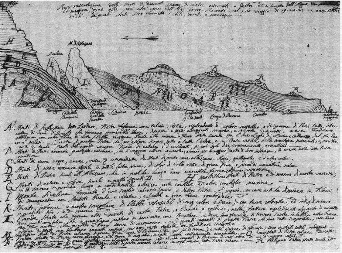
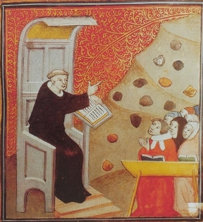
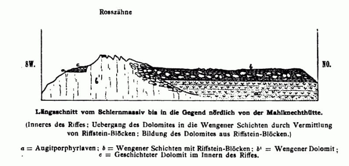
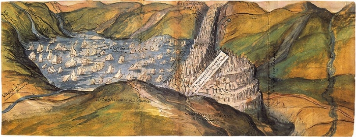
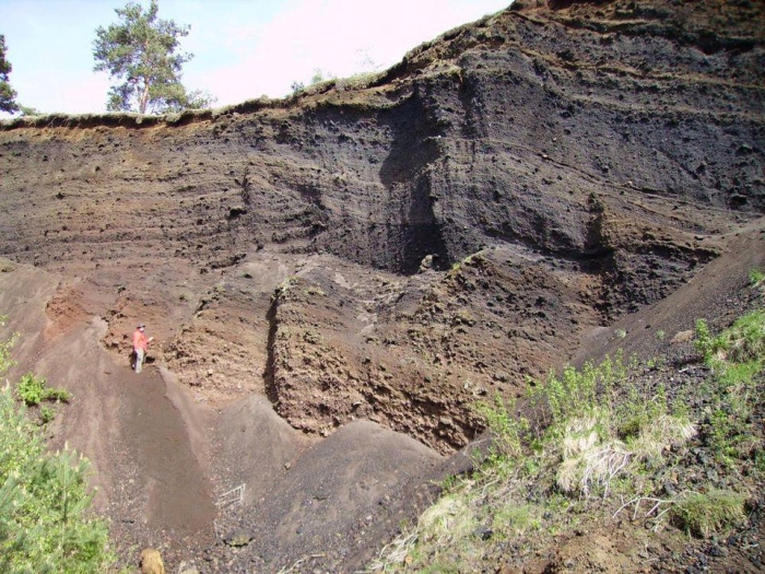
The Gévaudan and Auvergne were rural areas, characterized by a rugged and mountainous landscape. Just some years before the killings, physician Jean-Etienne Guettard visited the region. During his visit of Vichy, a city in northern Auvergne, he noted some strange dark rocks, used by locals to make bricks and roofing shingles (“roche tuiliére” in French).

Stone wall made from sections of basalt columns. Town of Murat, Massif Cantal.

Guettard was also interested in geology, offering his skills to rich collectors, helping them classify their rock samples. He noted that the roche tuiliére were very similar to samples of lava coming from Mount Etna in Sicily and hosted in the collection of the Count Of Orléans. Guettard correctly concluded that large parts of the Auvergne and some parts of the Gévaudan were formed by lava flows of ancient, now extinct, volcanoes.

The Francois Pasumot and Nicolas Desmarest volcano-geomorphological map of part of Auvergne, 1774, showing lava flows and volcanic cones.

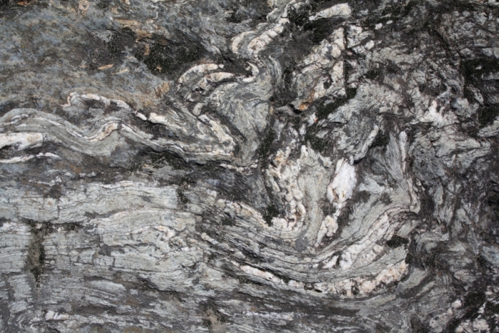
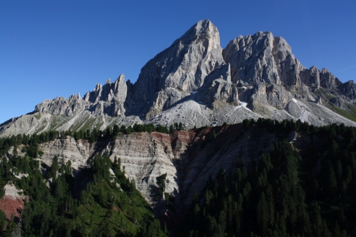
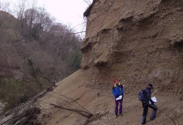
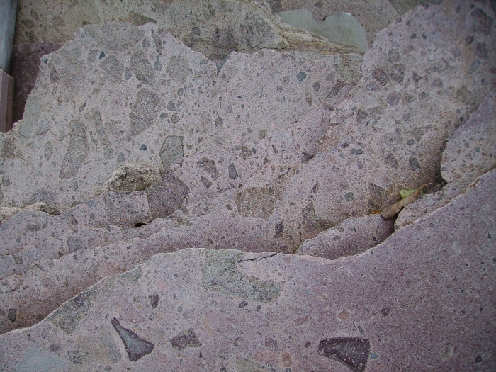
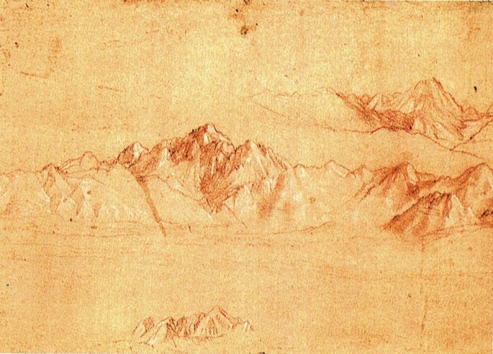
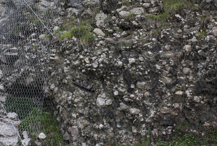
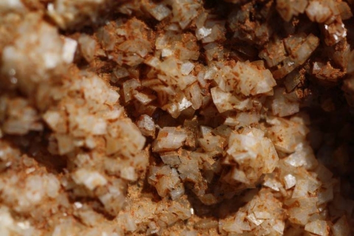
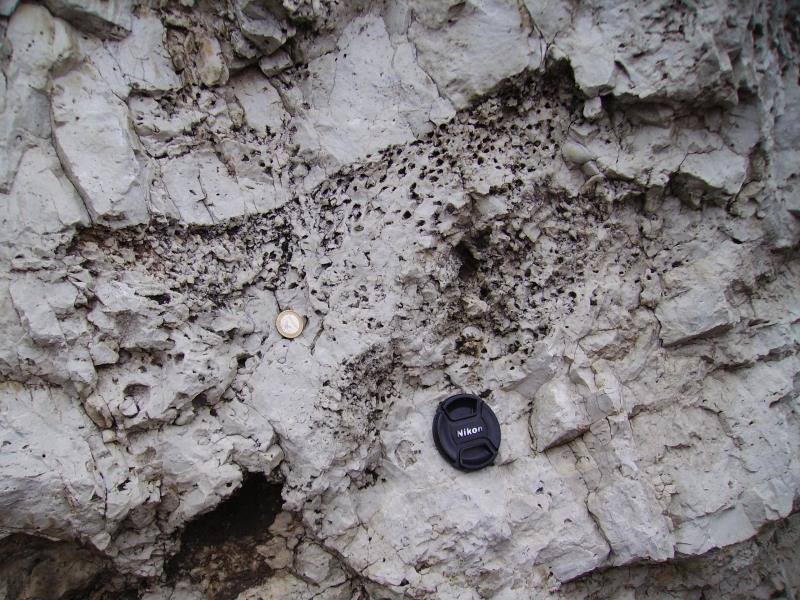
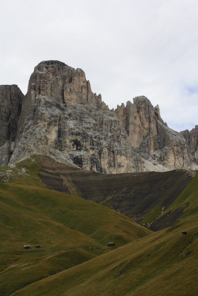
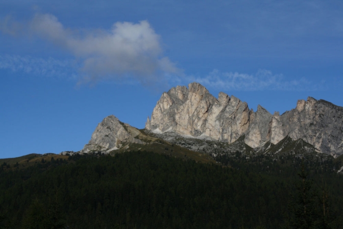
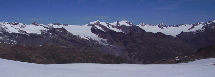
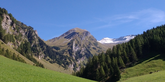
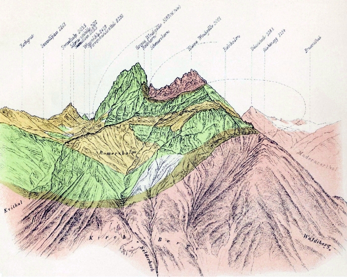
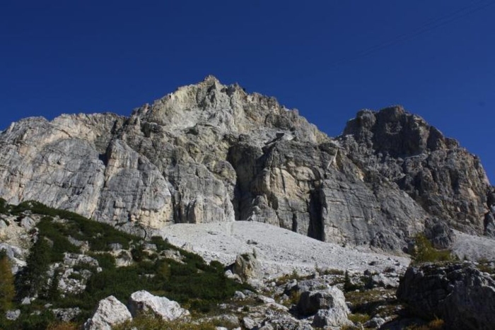
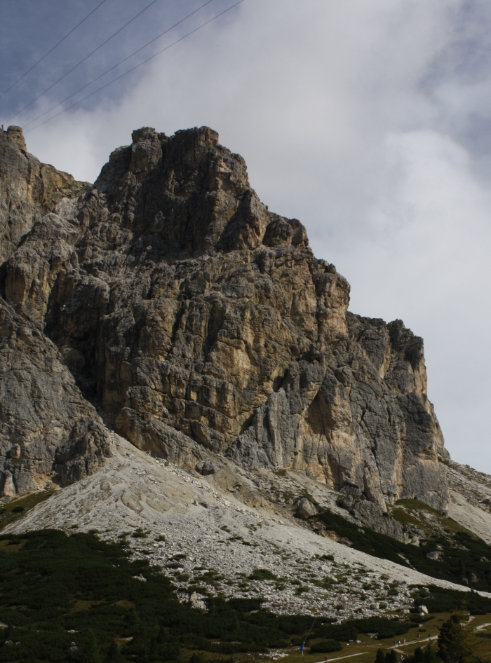
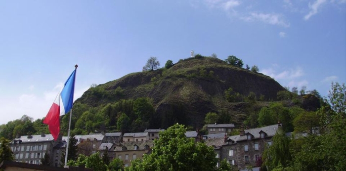
Various types of rock characterize the area where the Beast of Gévaudan preyed on its victims. The central highlands of Margeride are composed mainly of old metamorphic granitoids (rocks of magmatic origin) and gneiss. The mountain massifs of Cantal, Aubrac and Velay, surrounding the Gévaudan, are composed mainly of younger basaltic lava. Some sedimentary rocks are found in the south.

Simplified geological map of the Gévaudan with recorded attacks by the Beast.

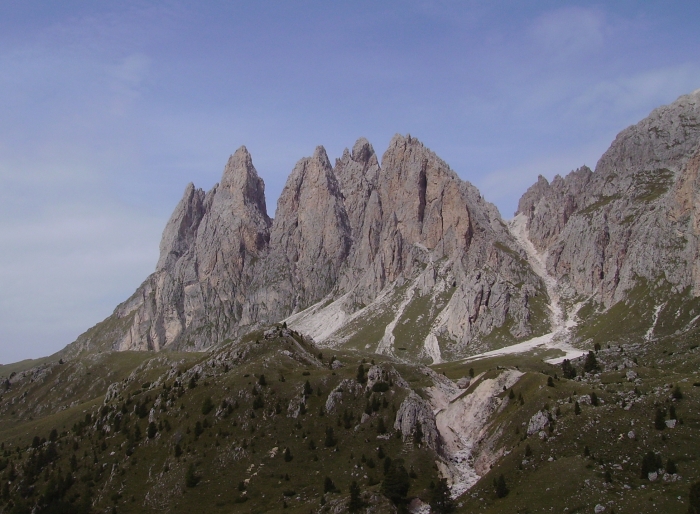
The metamorphic rocks forming the highlands are impermeable to water, the landscape here is characterized by gentle rolling hills, covered by a mosaic of meadows, forests, and swamps. The surrounding volcanic rocks are very resistant to weathering, the landscape here is characterized by a more rugged terrain. Lakes formed by volcanic explosions, volcanic cones and many rocky outcrops of basalt and tephra prevail.

Swamp landscape with eroded volcanic cones in the moor of Narse.

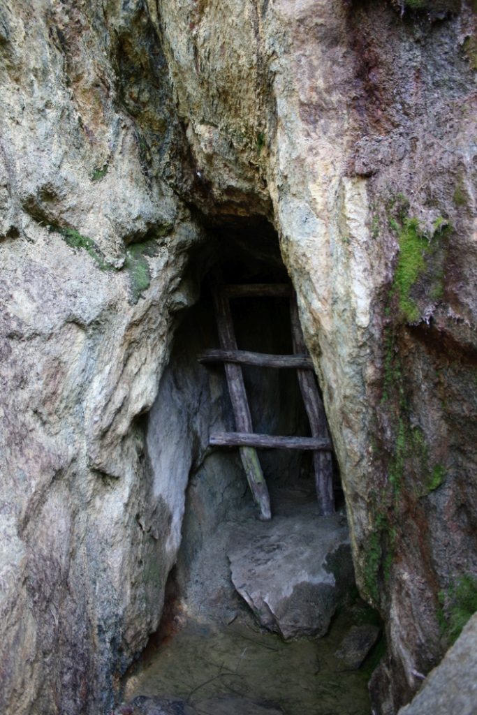
It was extremely difficult to hunt on such a terrain. The hunter D´Enneval de Vaumesle noted after a first survey of the area that “this Beast will not be an easy catch.” Horses could not be used in the swamps, and the creature could easily escape in the forests, hide between the rocky outcrops, or find shelter in caves and crevasses.

Outcrop of volcanic rocks in the extinct volcano of Puy de l’Enfer.

The Cantal Massif, with some peaks over 1.500 meters high, also acts as a barrier for clouds. The weather in the Gévaudan was notoriously bad, with cold and long winters and wet summers. Again and again the Beast escaped into the mist or hunters gave up the pursuit because of heavy rain.

View from the Puy Mary in the Cantal Massif, a large and ancient volcanic edifice.

Despite all efforts, the Beast continued to kill. King Louis XV. was even forced to replace Duhamel, sending his own gun-bearer François Antoine from Paris to the Gévaudan. But also Antoine, despite his experience, had difficulties with the terrain. Only in September 1765, he shot and killed an extraordinarily large wolf near the town of Murat in the Cantal Massif. The king himself announced the death of the Beast.

The town of Murat today, with outcrop of magmatic rocks and a volcanic cone in the background.

But just two brief months later the attacks resumed.

The mysterious killings continued until July 1767, when the local hunter Jean Chastel shot another large wolf in the forest of Teynazére, on the highlands of the Margeride. Until its final demise, the Beast (or maybe a pack of wolves) had killed at least 116 children and women and wounded many more.

References:

  • SMITH, J.M. (2011): Monsters of the Gévaudan – the Making of a Beast. Harvard University Press:378
  • TAYLOR, K.L. (2007): Geological travellers in Auvergne, 1751 –1800. From: WYSE JACKSON , P. N. (ed.): Four Centuries of Geological Travel: The Search for Knowledge on Foot, Bicycle, Sledge and Camel. Geological Society, London, Special Publications, 287: 73–96

Giovanni Arduino And The Geology Of The Dolomites

» [I worked] still young in the mines of Klausen and elsewhere in Tyrol, in order to learn Metallurgy; I went there by chance, and I was urged to stay by my natural very strong inclination for the universal Mineralogy, and for all the matters concerning the Science of the Fossil Kingdom. «

Venetian scientist Giovanni Arduino worked at an early age as a mining assistant in the iron mines of Klausen in South Tyrol.

Italian mining engineer Giovanni Arduino (1714-1795) is considered nowadays the spiritual father of the modern chronostratigraphic chart. Based on his observations in the Venetian Dolomites and Tuscany in 1759 Arduino proposed “a series of layers forming the visible crust of earth … ” subdivided “in four generalized units following each other.” He named them primary, secondary, tertiary, and quaternary, speculating that they formed at various times and under different environments.

Arduino used a section of rocks exposed in the Val dell´Agno (Venetian Dolomites) to explain his classification. The numbers refer to the thickness of the strata, the letters to the description in the accompanying text. The extremely tattered state of the original drawing suggests that Arduino showed it repeatedly to the many naturalists who visited him.
  • Primary Layer: Pebbles formed by the erosion of underlying “primitive or primeval” – considered to be the earliest – rocks. Fossils were rare, if not absent. This unit includes unstratified or poorly stratified rocks, like porphyry, granite and schist, of the crystalline basement of the Dolomites. Arduino’s rock unit survives into modern chronostratigraphic charts as the Paleozoic Era (rocks older than 252 million years) and Precambrian Eon (541 million years to about 4.6 billion years ago).
Mica shist as crystalline basement rock of the Dolomites, Arduino’s Primary Rocks.
  • Secondary Layer: A well-stratified succession of marl- and calcareous rocks with marine fossils, making up the characteristic peaks of the Dolomites. In 1841, English geologist John Phillips, based on the correlation of fossils in rock strata worldwide, renamed this sedimentary succession the Mesozoic Era (252 to 66 million years ago).
Sas de Pütia showing Arduino’s Secondary Rocks, the well-stratified red Gröden-Sandstone, grey Bellerophon limestone and fossil-rich reef limestone.
  • Tertiary Layer: Poorly consolidated sediments like gravel, clay, fossiliferous sand, and also younger volcanic rocks. Our modern Cenozoic Era (66 to 2 million years ago).
A conglomerate of the Tagliamento catchment, dating into the Pleistocene to Miocene according to our modern stratigraphic system (2-23 million years). Similar deposits were Arduino’s Tertiary Rocks.
  • Quaternary Layers: Unconsolidated sediments found in valleys. Our modern Quaternary Period (2 million years ago to modern age).

Pyroclastic Flows of the Athesian Volcanic Group

May 8, 1902, began as a sunny day in Martinique, an island in the Caribbean, with only a column of steam rising above Mount Pelée. When the volcano suddenly exploded.

The first rescuers arrived on the site twelve days after the eruption, accompanied by British, French and American geologists. In the city of St. Pierre, almost all of the buildings had been destroyed and an estimated 20.000-40.000 people killed.

» I looked back and the whole side of the mountain, facing towards the town, seemed to open and topple down on the screaming people. I was burned by stones and ashes …, but I got to the cave «

Havivra Da Ifrile, a girl who survived the destruction of St. Pierre hiding inside a cave near the shore.
Photographs of the city of St. Pierre before and after the eruption of Mount Pelée, the volcano is seen in the background (from LACROIX 1904, NHM Paris).

Geologist Edmund Hovey of the American Museum of Natural History, among the first to arrive to the destroyed city, noted that “In many places the limit [of the devastation] passes single trees, one side is dark and burned, the other green as if an eruption never happened.” A lava flow or landslide could not explain the burned trees nor could it explain the sharp boundary between the destroyed and untouched areas.

Two months later, geologists Tempest Anderson and John S. Flett of the Royal Society of London survived a smaller eruption of Mount Pelée.

» The cloud had a spherical form and resembled rounded protuberances amplifying and doubling with terrifying energy. They extended to the sea, in our direction, boiling and changing shape at every moment. It didn’t spread laterally. It didn’t rise up in the atmosphere, but it descended on the sea as a turbulent mass… «

Sequence showing a pyroclastic flow photographed December 1902 by French volcanologist Alfred Lacroix (from LACROIX 1904).
Alfred Lacroix.

For the very first time geologists observed a deadly nueé ardente – an incandescent cloud or glowing avalanche as the phenomenon was first named by French volcanologist Alfred Lacroix in 1904. A nueé ardente, in modern literature referred to as a pyroclastic density current, is a mixture of volcanic material and hot gases. Because its density is greater than air, it sinks downward, flowing like an avalanche along the slopes of a volcano. Pyroclastic flows can originate from the collapse of the eruption column, from a lateral blast or from the partial collapse of a volcano.

Researchers were able to estimate temperatures inside the pyroclastic flow that destroyed St. Pierre based on the observation that bottles melted (glass melts at ~700°C), but copper tubes were not deformed (copper melts at 1.100°C). The geologists, therefore, concluded that temperatures of a pyroclastic flows can range between 700 to 1.000°C. The high temperatures inside a pyroclastic flow also explain why so many people perished in St. Pierre. The heat was so intense that it instantly burnt the outer layers of skin and flesh. As the flesh shrinks due to the loss of water, the inner organs were squeezed out from their cavities. Even those not hit directly by the pyroclastic flow weren’t spared. Inhaling the still 300°C hot gases, their lungs quickly filled with liquid, drowning them.

The photo shows a 200 million-year-old ignimbrite – a name used for lithified deposits of a pyroclastic flow and derived from the Latin word for fire – of the Athesian Volcanic Group. Some of the larger clasts in the photo show an outer rim, indicating that the temperature inside the pyroclastic flow was high enough to alter the mineralogical composition of the rock. The larger rocks are embedded into a matrix of volcanic ash. Pyroclastic flows – a mixture of rocks, overheated gases and vapour – are able to transport even large boulders at a speed of 160km/h. As a result, the impacting mass destroys everything in its path, as happened to the town of St. Pierre.

An exceptional fossil discovered in 1931 in Athesian Volcanic Group deposits – “Tridentinosaurus antiquus by GB Piaz” – The skeletal remains are surrounded by a carbonaceous patina of soft parts, making it the oldest body fossil found in the Southern Alps. It is suggested by some authors, based on the preservation of the fossil, that the animal was killed during a volcanic eruption by a pyroclastic surge.

References:

The Fossils Of The Dolomites – From Myth To Science

The first scientific mention of fossils from the Dolomites dates back to August 18, 1741. In a lecture with the title Dissertatio de Fossilibus universalis Diluvii by Franz Ferdinand von Giuliani, physician in the city of Innsbruck, he describes petrified shells from the Puster-Valley as evidence for the biblical flood (a popular explanation at the time). Since the Puster-Valley is cut into metamorphic rocks like schist and gneiss, rocks that contain no fossils, Giuliani probably was describing fossiliferous formations from the nearby Dolomites.

Fragment of an ammonite, an extinct group of marine mollusc animals.

In the Dolomites, the remains of ancient reefs and marine basins, it is easy to spot and find fossils. Since ancient times shepherds and farmers have found fossils in the pastures and on their fields. People wondered about the origins of the strange rocks, and for a long time myths and stories provided some explanations. For example, cloven hoof-like impressions found on rocks were explained as the devil’s footprints.

Section of Megalodus sp. or the devil’s hoof shell.
The fossil casts of Bellerophon, an extinct genus of marine snail, were also referred to as the devil’s curled horns.

Between December and January and during the Walpurgis Night (April 30th to May 1st) the devil will join the witches’ sabbath on the 2.563 metres high Schlern. Dancing all night long, at dawn the devil will return to hell, leaving behind only the imprints of his hooves on the bare rocks of the Dolomites.

In the Puster-Valley the devil is called “Tuifl” or “Krampus” and has the appearance of a half human–half goat demon, including cloven hooves.

It wasn’t until 1781, after naturalists compared the strange imprints with shells of modern mollusks, that they recognized that the devil’s hooves, in reality, are the cross-sections of bivalves. Some 216 to 203 million years ago large bivalves of the family Megalodontesidae lived on the muddy bottom of the Tethys Ocean. After their death, the shells were buried and partially filled with fine carbonate mud. The sediments of the Tethys Ocean were pushed upwards by tectonic movements some 65 to 40 million years ago. Today erosion slowly removes the surrounding sediment revealing the heart- of hoof-like sections of the cockle-like animals.

Megalodus sp. fossil casts.

And it wasn’t until the 19th century that the fossils of ancient sea creatures were seen as evidence that the Dolomites like Venus, the ancient goddess of beauty, were born out from the sea in the geological past.

Geological Knowledge in the “Dark Ages”

“And how will you explain to me the fact of the pebbles being struck together and lying in layers at different altitudes upon the high mountains.”

Leonardo da Vinci, 1508.
The Alps, ca. 1513, red chalk drawing by Leonardo da Vinci. He was fascinated by mountains and called them the “bones of the earth.”
The Conglomerato della Marmolada is a volcaniclastic succession consisting of conglomerates and sandstones accumulated in the basinal area comprised among the lower Ladinian carbonate platforms of the Dolomites.

The period between the fall of the Roman Empire and the Renaissance in the 17th century is sometimes referred to as the Middle or Dark Ages. Used nowadays often as a derogative term, it reflects more our poor understanding of those times then a real cultural demise.

In ancient times the Alps, especially the alpine pastures and rocky outcrops above the tree line, were referred to as Gamsgebirg – the chamois mountains. Only shepherds, collectors of plants and minerals and chamois hunters visited this area and maybe sometimes climbed a mountain. However, in the Middle Ages, rich ore deposits were discovered in the Alps. Schwaz in Tyrol, Schneeberg and Prettau in South Tyrol were famous for the silver and copper mined between the Alpine peaks.

Mining for metals in the Alps dates back at least for 4.800 years (a 25-meter long gallery in North Tyrol was dated to 2.800 BCE). In South Tyrol slag remains were dated to 1.200-1.000 BCE. Slag remains found in Ahrntal possibly date back to the early and middle bronze age (3.300-1.800 BCE), even if the provenance of the used copper ore is unknown. The extraction of copper ore in the Ahrntal became important in medieval times, especially in the 15th century. At the time prospectors were searching for former copper mines and also used geological clues to find new ore deposits. There was likely a lot of empirical knowledge of minerals and rocks to be found between prospectors and miners. Unfortunately, most of this knowledge wasn’t written down. Some evidence for this “lost wisdom” can be found in traces left by the miners.

Ore veins in Rülein von Calw “Bergbüchlein,” 1500.

Some basic understanding of the geometry of ore veins was necessary to follow them in the mountain, and some basic understanding of rock quality was necessary to dig the galleries. Advancement was limited to millimeters for every work shift, maybe 5 millimeters per day in hard rock, 5 centimeters if the rock was fractured and soft. Many medieval mines follow fault systems inside the mountain, where the shattered rocks were more easy to excavate. Depending on the encountered rock, the section of the gallery was different. In soft rocks the gallery has a narrow section, pointed roof to better distribute the weight or is reinforced with wooden structures. In hard rocks, the gallery has a flat roof and a larger section.

Reconstruction of miners using a large joint to their advantage.
Medieval gallery in hard rock with flat roof and wide section.

The modern name of important minerals, like feldspar, derives from terms used by the miners. “Feld” is an old name for hard rocks and “spat” referred to any rock or mineral that if stroked by a hammer forms plain fracture surfaces.

First written records appear in the 16th century. Georgius Agricola (1494-1555) published in 1556 together with the miner Blasius Weffringer his De re metallica libri XII. In his “twelve volumes about metals,” he describes various ways to find hidden ore veins. Strange smelling water, springs with unusual deposits of red clay, colored spots of minerals on rocks, disturbed soil cover and crippled plants may indicate ore deposits hidden underground. In his De ortu et causis subterraneorum (1546) he briefly discusses the formation of mountains, by fire, water and wind. Erosion by water forms gorges, then canyons and finally separated mountain ranges. Wind and fire, in the form of volcanism and geothermal activity, play a major role in dismantling (volcanic) mountains.

Later authors, like cartographer Sebastian Münster (1489-1552), cartographer Johannes Stumpf (1500-1566), naturalist Conrad Gessner (1516-1565) and especially naturalist Johann Jakob Scheuchzer (1672-1733), describe mountains in great details, including plants, animals and rocks. However, few provide an explanation for their formation. Scheuchzer depicts and describes folds in the Swiss Alps, explaining them as layers deposited and then folded by the biblical flood. Italian author Valerius Faventies publishes in 1561 De montium origine, wherein he collects all the contemporary theories explaining the formation of mountains. An important role was given to celestial forces, causing rock and minerals to grow and expand inside Earth.

Lecture in mineralogy, from “De nuptiis Philologiae et Mercurii”, 17th century.

Literatur:

  • LEFEVRE, W. (2010): Picturing the world of mining in the Renaissance: The Schwazer Bergbuch (1556). Max-Planck-Institut für Wissenschaftsgeschichte

The Dolomites – beautiful Mountains born from the Sea

The French nobleman Diedonnè-Silvain-Guy-Tancrede de Gvalet, born June 23, 1750, in the village of Dolomieu, was a typical naturalist of his time. At the age of 26, de Dolomieu traveled through Europe, got interested in the mines of the Bretagne and the basaltic plateaus in Portugal, visited Italy to study the aftermath of an earthquake and to observe the erupting Mount Etna in Sicily. In 1789 he also visited Tyrol. At the Brenner Pass and between the cities of Bozen and Trento he noted a rock similar to limestone. However, unlike limestone, this rock showed no reaction with acids. He published this observation in July 1791 in a letter to the Journal of Physique.
Nicolas Theodore de Saussure, son of famous Swiss alpinist Horace Benedict de Saussure, requested some samples to analyze the chemical composition of this new kind of rock. In 1792, de Saussure published the Analyse de la Dolomie.

Dolomite the mineral.

The first mention of the Dolomites is found in the 1846 book The Horns of the Dolomite Mountains. Later the two alpinists Josiah Gilbert and G.C. Churchill helped to popularize the new name with their mountain climbing guide The Dolomite Mountains, published in 1864. The name Dolomites became popular after 1876, and was oficially adopted for the region after World War I.

Dolomites the mountains.

The geological genesis of the Dolomite Mountains was one of the great mysteries of the world. Fossils provided clues that the rocks composing the mountains were formed once in the sea, but in these early days of geology, almost nothing was known about the bottom of the sea and sedimentation in oceans.

In June 1770 the British explorer James Cook discovered, not entirely voluntarily as his ship the HMS Endeavour collided with it, the Great Barrier Reef of Australia. Here apparently gigantic mountains of limestone were formed by coral polyps and other marine organisms. But how could these mountains rise from the bottom of the sea and form a landscape on dry land?

Section of fossil corals.
Modern coral reef.

In 1772, during the second voyage of Cook, the German naturalist Georg Forster visited the atolls and volcanic islands of the Pacific Ocean. Forster observed that corals live in the first meters of the sea, but outcrops on land showed that the limestone produced by the coral polyps can be almost 300-600 meters thick. He developed a hypothesis to explain this observation. The corals grow slowly from the bottom of the sea until reaching the surface, where erosion levels the reef to form the plain surface of an atoll, then violent volcanic eruptions push the reef above sea level.

Almost fifty years later, another naturalist became intrigued by the mysterious connection between volcanoes, corals and atolls. During his voyage on board HMS Beagle, a young geologist named Charles R. Darwin studied Lyell’s Principles of Geology and the chapter about reefs in the Pacific stimulated his imagination. In February 1835, Darwin experienced a powerful earthquake in Chile and shortly afterward noted evidence of several meters of uplift in the region. According to Lyell’s view, Darwin imagined that mountains could rise and sink over time. Based only on the description in the book of atolls and assuming slow movements of the surface of the Earth, Darwin developed a preliminary hypothesis to explain the formation of atolls in the middle of the sea.

“No other work of mine was begun in so deductive a spirit as this; for the whole theory was thought out on the west coast of S. America before I had seen a true coral reef. I had therefore only to verify and extend my views by a careful examination of living reefs. But it should be observed that I had during the two previous years been incessantly attending to the effects on the shores of S. America of the intermittent elevation of the land, together with the denudation and deposition of sediment. This necessarily led me to reflect much on the effects of subsidence, and it was easy to replace in imagination the continued deposition of sediment by the upward growth of coral. To do this was to form my theory of the formation of barrier reefs and atolls.”

Darwin recognized that the animals forming the corals needed sunlight, so the corals couldn’t grow on the dark bottom of the sea. He imagined that corals would colonize extinct volcanoes. As the volcanic islands slowly erode they sink into the sea. These movements are slow enough to enable the corals to compensate the subsidence and keep living near the surface of the sea, where plenty of light and nutrients are available. Darwin’s hypothesis was very speculative, based only on superficial observations – there was simply no way to study the shape and base of coral reefs at the time.

American geologist James Dwight Dana, who in 1838-1842 visited the Pacific, confirmed most of the observations of Darwin. Important modifications to the reef-theory were added in 1868, when the German zoologist Carl Semper studied atolls. In 1878 and 1880 the oceanographer John Murray published his observation made during the Challenger-Expedition (1872-1876) on the islands of Palau and the Fijis. He postulated that reefs grow on submarine elevations of any kind if they are high enough, not only volcanoes. This new theory was strongly supported and improved over time by geologists. Atolls grow up from shallow submarine elevations of various origins. Corals in the middle of the reef will die due the reduced circulation of water, then the calcareous skeleton of the reef building organisms is dissolved by the agents of erosion. In the end a lagoon and the characteristic shape of an atoll forms.

Such observations of living reefs in the tropical seas provided new impulses to interpret the geological relationships in the Dolomites. In 1860 the Austrian geologist Baron Ferdinand F. von Richthofen visited and studied the Dolomites. He discovered that the sandstone and tuff deposits, surrounding the isolated peaks of dolostone, contained large limestone boulders, some containing still recognizable fossils of corals. Based on the theory of evolution of a reef as proposed by Darwin, Richthofen suggested that the isolated peaks were the intact remains of an ancient reef, still surrounded by clastic sediments of an ancient basin, in which, from time to time, landslides from the steep slopes of the reef deposited large boulders of corals.

Upper Triassic basinal succession. Notice the gradual transition between the volcanoclastic Wengen Fm (below,darker) and the more carbonatic S. Cassiano Fm. In the background the cliffs of Cassian Dolomite platform.
Clinostratification/Slope -bedding in the outer parts of the carbonate platforms of the Dolomites (after MOJSISOVIC 1879). Scheme of bedding on the flanks of carbonate platforms and examples of flank and basin deposits from the Sciliar/Schlern platform. Note the abundant limestone boulders in the basin sediments.

The young geologists Edmund Mojsisovics von Mojsvar developed further this reef hypothesis, mapping in detail the relationships between the single facies, ranging from the lagoon of the atoll to the open sea. Massive, many thousands of meter thick reefs of dolostone changed suddenly to well-bedded carbonates, deposited in a central shallow lagoon. The former slope of the reef was composed of tongues of reef debris interbedded within sandstones, shale and basalts deposited on the bottom of the sea. Such strong sedimentary facies changes were until then considered impossible. The reconstruction of the Dolomites as an ancient atoll landscape seemed so radical, Mojsisovics was forced to find a private publisher for his revolutionary work.

Settsass and Piccolo Settsass, also known as Richthofen-Riff. Here a Triassic reef with clinostratification into basin sediments (St. Kassian-Fm; Wengen-Fm, brown sandstones/shales/marls) is exposed by erosion.
Geological drawing of the Richthofen-Riff. Figure by MOJSISOVICS 1879.

The origin of the Dolomite Mountains as fossil reefs recalls the birth of Venus. Like the ancient goddess of beauty, the Dolomites were born out from the sea.

The Rosengarten Group by Josiah Gilbert, from Gilbert & Churchill’s “excursions through Tyrol, Carinthia, Carniola, & Friuli in 1861, 1862, & 1863 including a geological chapter, and pictorial illustrations from original drawings on the spot.”

References:

  • DOBBS, D. (2005) Reef Madness: Charles Darwin, Alexander Agassiz and the meaning of coral. Pantheon Books: New York
  • FISCHER, A.G. & GARRISON, R.E. (2009): The role of the Mediterranean region in the development of sedimentary geology: a historical overview. Sedimentology 56: 3-41
  • SCHLAGER, W. & KEIM, L. (2009): Carbonate platforms in the Dolomites area of the Southern Alps – historic perspectives on progress in sedimentology. Sedimentology 56: 191-204

Glacier Reseach in the Alps

“It has already been said, that no small part of the present work refers to the nature and phenomena of glaciers. It may be well, therefore, before proceeding to details, to explain a little the state of our present knowledge respecting these great ice-masses, which are objects of a kind to interest even those who know them only from description, whilst those who have actually witnessed their wonderfully striking and grand characteristics can hardly need an inducement to enter into some inquiry respecting their nature and origin.”

James, D. Forbes (1900): Travels Through the Alps.

Today glaciers are studied worldwide and monitored as climate proxies, and the recent measurements show that almost all of them are retreating. The story about glaciers, their influence on the landscape and their possible use to reconstruct and monitor climate is an intriguing one, with many triumphs, setbacks and changes of mind.

Alpine glaciers at the beginning of the 20th- and in the early 21st-century.

For centuries, if not even millennia, the high-altitude regions of mountain ranges were visited and traveled by man, however, they were also forbidding places. The glaciers, masses of ice enclosing peaks and extending their tongues into valleys, were considered haunted by mountain spirits.

Despite such myths, there were some early insights of what glaciers actually really are. Greek historian and geographer Strabo (63 BC – 23 AD) describes a voyage through the Alps:

“… there is no protection against the large quantities of snow falling, and that form the most superficial layers of a glacier … []. It’s a common knowledge that a glacier is composed by many different layers lying horizontally, as the snow when falling and accumulating becomes hard and crystallizes … []”

However, this early knowledge got lost and was only rediscovered in the Renaissance. Between 1538 and 1548 glaciers were labeled (even if not depicted) with the term “Gletscher” on topographic maps of Switzerland. The first historic depiction of a glacier is considered the watercolor-painting of the Vernagtferner in the Ötztaler Alps, dated to 1601. The Vernagtferner was a glacier that repeatedly dammed up the glacial lake Rofen, which outbursts caused heavy damage and loss of property, particularly in the years 1600, 1678, 1680, 1773, 1845, 1847 and 1848.

The valley of Rofen with the advancing Vernagtferner and ice-dammed lake, after Abraham Jäger , 1601.
The valley of Rofen with the Vernagtferner (on the right) in 2007.

Swiss naturalist Johann Jakob Scheuchzer, visiting in the year 1705 the Rhône Glacier, published his observations of the “true nature of the springs of the river Rhône” in the opus “Itinera per Helvetiae alpinas regiones facta annis 1702-1711″, and confirms the idea that glaciers are formed by the accumulation of snow and they move and flow. The increasing interest to study glaciers in the Alps is also encouraged by enthusiastic travel reports. A.C. Bordier describes in his “Voyage pittoresque aux glaciers” (1773) the Bosson glacier as a “huge marble ruins of a devastated city.” Swiss naturalist Horace Benedict de Saussure was fascinated by the mountains of his homeland and an enthusiastic alpinist. After 1760 he traveled more than fourteen times through the Alps (considering the possibilities in this time an extraordinary achievement) to explore valleys and mountains. In the years 1767 to 1779 the first volume of his “Voyages dans les Alpes” was published, where he collected his observations and theories about the visited glaciers. He recognized moraines and large boulders as the debris accumulated by the glacier and proposed to map them to determine the former extent of glaciers. Despite this exact statement, de Saussure failed to connect large boulders found in the foreland of the mountains to the glaciers of the Alps. He assumed that these rocks were transported to their recent locations by an immense flood. The biblical flood explained why boulders found scattered around the plains of Germany came from outcrops located in Scandinavia or the Alps. However, to transport the boulders from the mountains, the flood had to reach 1000s of meters.

Despite such problems, the idea of a flood as the explanation for “glacial” deposits in Europe was largely accepted. Even famous 19th-century geologists like Charles Lyell and Charles Darwin assumed that huge erratic boulders were transported by ice-rafts. That glaciers could flow far out of their valleys was, however, not an impossible idea for local inhabitants, who observed and experienced the growth and retreat of glaciers.

In 1815 the Swiss chamois hunter Jean Pierre Perraudin discussed with the engineer Ignatz Venetz his theory of former glaciers covering the Val de Bagnes. Impressed by such an idea, Venetz mapped geological features that made him recognize that not only the studied valley was once covered by ice, but the entire Swiss Alps. Vernetz’s lecture at the assembly of the Swiss Association for Natural History in 1829 was meet little interest. Only Jean de Charpentier, director of the salt mine in the city of Bex, was interested in this new theory. Charpentier himself started a detailed mapping project and in 1834 presented before the Swiss Association the results of his investigations, but again the ice-age theory was met with more criticism than interest. One of the critics in the public was a former student of Charpentier, named Jean Louis Rodolphe Agassiz, a young but respected paleontologist. Charpentier invited Agassiz to visit the city of Bex and surrounding mountains, to observe the recent glaciers and test the theory of former glaciers covering the Alps. In 1837 Agassiz held an enthusiastic lecture about glaciers and ice-ages. Three years later he published a detailed study of modern glaciers in his “Etudes sur les glaciers.” However, even Agassiz experienced the same skepticism as many other ice-age proponents before. His friend, the

“I think that you should concentrate your moral and also your pecuniary strength upon this beautiful work on fossil fishes … In accepting considerable sums from England, you have, so to speak, contracted obligations to be met only by completing a work which will be at once a monument to your own glory and a landmark in the history of science … [] … No more ice, not much of echinoderms, plenty of fish …”

German geographer Alexander von Humboldt in a letter to Agassiz.
Glacial polished surfaces in Agassiz‘s 1840 glacier book and on an outcrop.

However, Agassiz didn’t surrender to criticism so easily and decided to use his good connections to the most important geologists of his time to popularize the ice-age theory. Agassiz’s research on the Unteraar-glacier in Switzerland established the foundations of glaciology; he recorded the dimension of the glacier, its velocity and even ventured inside the glacier by passing through a glacial mill. Soon after, the measurements methods introduced by Agassiz were carried out on various glaciers of the Alps and repeated nearly every year. The historical records showed various fluctuations, but since 1850 the glaciers in the Alps are quickly retreating. Especially in the last decades, the vanishing glaciers are a cause of concern, as they are unequivocal signs of a warming climate.

Literatur:

  • KRÜGER, T. (2008): Die Entdeckung der Eiszeiten – Internationale Rezeption und Konsequenzen für das Verständnis der Klimageschichte. Wirtschafts-, Sozial- und Umweltgeschichte Bd., Schwabe Verlag: 619

Why Plate Tectonics was not invented in the Alps

“Like Venus, the theory of plate tectonics is very beautiful and born out of the sea.”

R. Trümpy, 2001

For over 200 years the Alps have been visited by geologists. For most of this time, they wondered how mountain ranges like the Alps formed. Folded sediments suggested forces pushing and squeezing the rocks. In the 18th century Swiss naturalist Johann Jakob Scheuchzer depicts and describes folds in the Swiss Alps, explaining them as layers deposited and then folded by the biblical flood.

The mountains around the Urnersee, from Scheuchzer´s “Helvetiae Stoicheiographia”, published in 1716.

German geologist Leopold von Buch (1774-1853) was convinced that mountains form like a bubble in Earth’s crust. Large magma intrusions displace and fold the superficial sedimentary layers. Von Buch believed that his theory could also explain the complex geology of the Alps, with magmatic and metamorphic rocks forming the inner zones and sedimentary rocks (like found in the Dolomites and the Northern Calcareous Alps) forming the outer borders. Based on von Buch’s research, French geologist Elie de Beaumont proposed that tilted and folded layers of different age were formed by periodic “magmatic” pulses. At first, the horizontally deposited sediments are uplifted by the intrusion of a magmatic core. In a second phase, the layers become tilted and then new layers form by the erosion of older layers. The undeformed layers are tilted by a new orogenic cycle and so on. However, British geologists later showed that this theory couldn’t work as proposed. If a mountain formed around a magma intrusion, all the sedimentary layers should show similar strike and dip, but the strata in the Alps were tilted chaotically.

Central Gneiss of the Tauern Window (covered by snow) surrounded by former sedimentary rocks, now thick-banked marble (mountain in the middle of the photo) and schist (on the left) of the Penninic Ocean. Seen at first as evidence of von Buch’s theory of magmatic rocks uplifting sedimentary layers, nowadays it is seen as a example of the Alpine nappe structure. Here partial erosion removed part of the nappe, forming a tectonic window, where the oldest rocks found in the Alps remerge to the surface.
Elie De Beaumont’s mountain-building theory: (1) previously horizontal beds (b), tilted up and contorted on flanks of rising core (a), and younger flat beds (c) extending up to the foot of the chain;(2) in this case, also beds (c) are disturbed and flanked by new horizontal deposits (d).

A new theory – the Contracting Earth theory – was later formulated by American geologist James Dwigth Dana. This theory explained mountains and continents as products of a cooling and shrinking Earth. Like the surface of an old and dry apple, the shrinking Earth would develop fissures (basins) and wrinkles (mountains).

Austrian geologist Eduard Suess suggested in his book Die Entstehung der Alpen (1875; The Origin of the Alps) and multi-volume work Das Antlitz der Erde (1883-1909; The Face of the Earth, English edition 1904-1924) that deep-sea trenches found along the borders of the Pacific Ocean are zones where the seafloor is pushed beneath the continents. However, also Suess imagined that “the horizontal and uniform movements” of rock layers could be explained by variations in Earth’s circumference. In 1906, Austrian geologist Otto Ampferer imagined with his “Unterströmungstheorie“ large currents in Earth’s mantle, pulling the upper crust, creating mountains like folds in a carpet. However, Ampferer and many other geologists working in the Alps used such theories only to explain very localized tectonic movements, like the thrust belt found in the Northern Calcareous Alps, mapped by Ampferer.

Thrusts had been noted in the Alps since the middle of the century, for example by Bernhard Studer (1853) and Arnold Escher (1841). In the Glarus Alps a spectacular thrust – here older Permian red beds and Mesozoic limestone cover younger Eocene to Oligocene Flysch – was explained by Escher and later by Albert Heim as a large “double fold”, a recumbent fold with inverted layers. In 1884, Marcel Bertrand proposed that a single, north-facing tectonic nappe could explain the inverted stratigraphy. The nappe was thrusted on older layers by the gravitational collapse of the mountains, when single sheets of sedimentary rocks sliding downwards get stacked atop each other.

Section with the “Glarus double fold” by Albert Heim, from Livret- Guide Géologique, 1894.
A. Heim’s 1878 drawing of the Windgällen. Pink: in the foreground steeply inclined basement gneisses, on the Kleinen Windgällen late Paleozoic rhyolites; brown: Middle Jurassic formations; green: Upper Jurassic limestones (Hochgebirgskalk); yellow: Paleogene, mainly Eocene Flysch.

The Contracting Earth theory could explain the immense forces needed to crack and fold rocks on a global scale. However, it failed to explain the irregular distribution of mountains on Earth. According to the Contracting Earth theory,  features like mountain ranges should be distributed randomly on the uniformly shrinking planet. However, even a short glimpse on a map or globe shows that mountain ranges are not randomly distributed, but rather form long chains, like the Alps, the Caucasus and the Himalayas; or are instead found along one side of a continent, like the Rocky Mountains or the Andes, but not on the other side.

Tectonic map of Europe published by Eduard Suess in 1893. Suess was among the first to describe the tectonic structure of the Alps and together with Franz von Hauer he worked on a geological section. He recognized that European mountain-ranges were the product of at least three distinct orogenic cycles – the Alpine System (Alps, Pyrenees, Dinarides), the Variscian System (Bohemian Mass and truncated uplands in Spain and France) and the Caledonian System (truncated uplands in England and Scandinavia).

In January 1912 the German meteorologist Alfred Wegener presented in his public lecture Die Heraushebung der Großformen der Erdrinde (Kontinente und Ozeane) auf geophysikalischer Grundlage (The formation of large features of Earth’s crust (Continents and Oceans) explained on a geophysical basis) for the first time his idea of the ancient supercontinent Pangaea, from which all modern continents split apart. Three years later he publishes his book Entstehung der Kontinente und Ozeane, translated in the third edition and published in 1922 as The origin of continents and oceans. According to Wegener, ocean basins form as continents split apart, mountains are formed as continental crust collides with the oceanic crust or other fragments of continental crust. Swiss geologist Émile Argand used in 1916 Wegener’s hypothesis to explain the closure of the Tethys Ocean, once located between Europe and Africa, and subsequent folding and overthrust of marine sediments on the continental crust of Europe.

Swiss geologist Emile Argand’s 1916 diagram of the western-Alpine geosyncline during its initial contraction (embryotectonics) with syn-orogenic emplacement of mafic magma (black, Piedmont ophiolites) along the sheared lower limb of the Dolin-Dent Blanche geoanticline. Simplified legend: (1) rigid foreland, (2) epicontinental basin, (3) Valais foredeep, (4) Gran St. Bernard nappe (5) Piedmont basin, (6) Dolin-Dent Blanche nappe.
Argand adopted between 1909 and 1934 the idea of nappes in the geology of the Alps, here a generalized view of the Europe-vergent Alpine thrust belt. Note that the Eastern Alps (4) override the western Alpine nappe stack (2-3), and its root zone is indented and back-folded by the Southalpine hinterland, in turn, deformed by south-vergent thrust. The Western Alps consist of ophiolite-bearing cover sequences (3) and Penninic nappes (2), squeezed out from the contraction of Alpine geosyncline (I-III: Simplon-Ticino nappes;IV-V-VI: Gran St. Bernard-Monte Rosa-Dent Blanche nappes), and overthrown onto the sliced (a-b: Helvetic basement) and undeformed (c) European foreland (1).

Despite Argand’s nappe theory could explain many mysteries of Alpine geology, like old and young rocks found together or the tectonic structure of the Alps, it would need almost another 50 years until it was widely accepted.

Argand’s 1911 cross-section of the Swiss Alps showing the tectonic nappes of the Adriatic microplate (in red and numbered VI), subducted Penninic Ocean (blue), Briançonnais microcontinent (violet and numbered V), European Plate (pink and numbered IV). The Dent Blanche nappe hosts also the famous Matterhorn, old African continental crust overthrusted onto younger sediments and oceanic crust of the Penninic Ocean.

Wegener’s continental drift theory (a catchy phrase adopted mainly by his critics, as Wegener talks more general of displacement theory) was received with mixed feelings. Most geologists regarded it as cherry-picking of data. Only a few geologists became convinced of his idea. Wegner himself reacted to the critics and tried to respond to them in various editions of his book, however with moderate success. The greatest problem facing Wegener was the lack of direct evidence for the movements of continents. No mechanism was known to be powerful enough to move entire continents. Wegener proposed gravitational pull, tidal and centrifugal forces, but British geophysicist and astronomer Harold Jeffreys (1891-1989) demonstrated that such forces are too weak to explain moving continents. Wegener will die in 1930. His continental drift theory is in many aspects erroneous. Not the single continents move, but fragments of Earth’s crust and the driving forces comes from within the planet, not from the outside. But Wegener’s work introduced the idea of moving continents to the scientific community and the public and decades later this legacy will influence a new kind of theory – modern Plate Tectonics.

Between 1959 and 1977, geologists Marie Tharp and Bruce Charles Heezen, published the first maps of the seafloor, showing what seemed to be large rift zones, where new crust can form as lava pours out from submarine fissures. Canadian geologist John “Jock” T. Wilson introduces in the 1960s with the mid-ocean ridges (where new crust forms), subduction zones (where old crust sinks back into Earth’s mantle) and transform faults (accommodating lateral movements) the modern elements of plate tectonics. Harry Hammond Hess, US Navy commander at Iwo Jima, a prospector in Zambia and later professor at Princeton, in 1962 publishes a paper that will become one of the most widely cited geophysics paper for years. He hypothesized that the seafloor widens along the mid-ocean rifts and crust movements are driven by currents in Earth’s mantle, providing also a mechanism for plate tectonics and so mountain building. (to be continued).

Austrian geologist Albrecht Spitz’s geologic cross sections of the Engadin Dolomites (1914), showing tectonic nappes and faults – a novelty at a time when most structures in the Alps were interpretated as large-scale folds.

References:

  • DalPIAZ, G.V. (2001): History of tectonic interpretations of the Alps. Journal of Geodynamics 32: 99-114
  • FRANKS, S. & TRÜMPY, R. (2005): The Sixth International Geological Congress: Zürich, 1894. Episodes, Vol. 28, no. 3: 187-192
  • HEIM, A. (1919-1922): Die Geologie der Schweiz.
  • SEARLE, M. (2013): Colliding Continents: A geological exploration of the Himalaya. Oxford University Press: 438
  • STÜWE, K. & HOMBERGER, R. (2011): Die Geologie der Alpen aus der Luft. Weishaupt Verlag: 296
  • TRÜMPY, R. (2001): Why Plate Tectonics was not invented in the Alps. Int J Earth Sciences Vol. 90: 477-483
  • TRÜMPY, R. & WESTERMANN, A. (2008): Albert Heim (1849-1937): Weitblick und Verblendung in der alpentektonischen Forschung. Vierteljahrsschrift der Naturforschenden Gesellschaft in Zürich 153(3/4): 67–79

Battlefield Dolomites: How Geology Shaped Mountain Warfare

The Great War (1914-1918), fueled by technological innovations and the industrial revolution, was a new type of war. Every corner of the world was touched, from the sea to the highest peaks of the Alps. Entire landscapes were devastated by high-energy explosives.

The Lagazuoi overlooking the Falzarego-Pass in the Dolomites. During WWI the Austrian front-line followed the crest of the mountain, the Italians occupied the ridge in the middle of the cliff.

May 23, 1915, Italy declares war on Austria-Hungary, bringing the war also into the Dolomites. The Austrian military high command fears that the Italian army now can reach the capital city of Vienna in just a few days, so the local troops are ordered to fortify the most important routes and mountain passes in the region. There was no experience with combat in such an extreme environment. Braced by snow-capped mountains, neither side can find a way to dislodge their enemy.

Simplified geological map of the Alps.

Of strategic importance was the Falzarego-Pass. The nearly vertical cliffs of the Lagazuoi, a 2.835 meter-high mountain, overlook this pass. The Austrian forces fortified the mountain summit, attacked from below by the Italian forces. It was almost impossible to directly attack the enemy, defending himself with machine-gun nests and taking shelter behind rocks. The military tried to solve this problem with tactics first successfully adopted in the plains of France. Tunnel warfare involves the construction of long tunnels beneath the enemy lines, large quantities of explosives are then detonated to form a breach. In the Dolomites, explosions were also used to trigger rockfall and kill the enemy.

Machine-gun nest overlooking the Lagazuoi, hidden in a cavern built into Cassian-Dolomite.

In July 1916, to reach the Italian position located on a rock ledge (formed by a large fault) on the southern side of the Lagazuoi, the Austrian army started to dig a tunnel from the northern side. Adopting a similar strategy, the Italian army tried to dig a tunnel beneath the peak of the Lagazuoi. The Austrians detonated the first mine on January 14, 1917.

The Lagazuoi is composed of the Cassian-Dolomite, the dolostone core of a former Triassic reef. The relative plain summit of the Lagazuoi is formed by erodible marl deposits of the Heiligkreuz- and Travenanzes-Formation. The Falzarego-Pass and nearby Valparola-Pass are located in the former basin sediments (soft sandstone and marl formations) separating the Lagazuoi reef from nearby carbonate platforms.

Cross-section through the Lagazuoi. a) San Cassiano Fm; b) shallow-water deposits of the San Cassiano Fm; c) Cassian Dolomite; d) Heiligkreuz Fm ; e) Dibona sandstone, (1) lower member of marls, calcarenites and sandstones; (2) upper carbonate beds; f) Travenanzes Fm; g) Dolomia Principale (Trombetta 2011).

The hard dolostone is deformed and broken by tectonic forces. However, the rock was much harder to excavate than expected. Working incessantly the miners were able to advance 9 meters a day. Between 1915 to 1917, when the war in the Dolomites ended, more than 34 such tunnel blasting operations were attempted, 20 by the Italian and 14 by the Austrian military.

WWI trench on the Lagazuoi summit dug into the softer Heiligkreuz- and Travenanzes-Formation.

In 1917, shortly before detonating a mine, the Italian soldier Luigi Panicalli wrote: “I realize that in just some moments the results of all the months of work and suffering will become visible. I’m like petrified. In the last moments my thoughts are by the enemy – poor guys – do they feel death approaching? Do they know, that the enemy is inside the mountain, ready to blast them from the mountain down into their graves?“

Detonation of a mine on the Lagazuoi by the Italian forces May 22,1917, to dislodge the Austrain forces still occupying the summit. 41 soldiers were killed.
Crater and debris formed by a mine on May 22, 1917.
Crater and debris formed by mine detonation on June 20, 1917.

References: