» [I worked] still young in the mines of Klausen and elsewhere in Tyrol, in order to learn Metallurgy; I went there by chance, and I was urged to stay by my natural very strong inclination for the universal Mineralogy, and for all the matters concerning the Science of the Fossil Kingdom. «
Venetian scientist Giovanni Arduino worked at an early age as a mining assistant in the iron mines of Klausen in South Tyrol.
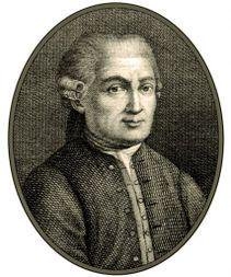
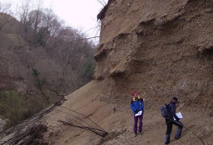
Italian mining engineer Giovanni Arduino (1714-1795) is considered nowadays the spiritual father of the modern chronostratigraphic chart. Based on his observations in the Venetian Dolomites and Tuscany in 1759 Arduino proposed „a series of layers forming the visible crust of earth … “ subdivided „in four generalized units following each other.“ He named them primary, secondary, tertiary, and quaternary, speculating that they formed at various times and under different environments.
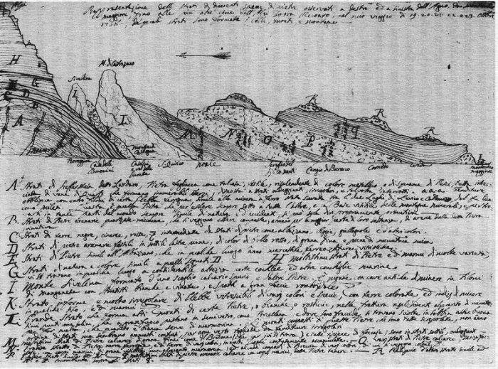
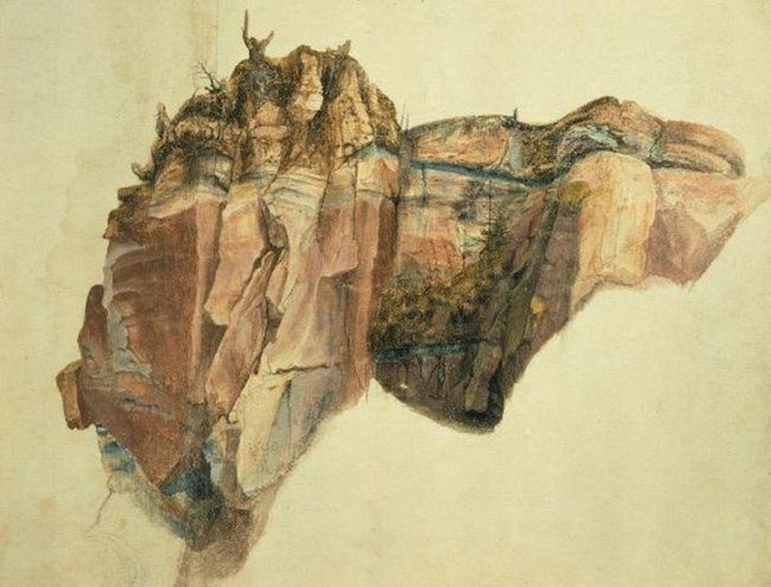
Arduino used a section of rocks exposed in the Val dell´Agno (Venetian Dolomites) to explain his classification. The numbers refer to the thickness of the strata, the letters to the description in the accompanying text. The extremely tattered state of the original drawing suggests that Arduino showed it repeatedly to the many naturalists who visited him.
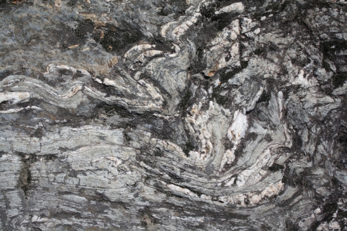
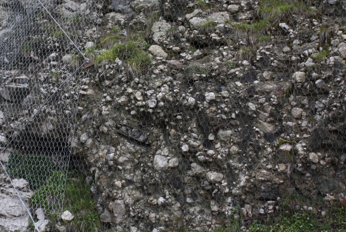
Primary Layer: Pebbles formed by the erosion of underlying “primitive or primeval” – considered to be the earliest – rocks. Fossils were rare, if not absent. This unit includes unstratified or poorly stratified rocks, like porphyry, granite and schist, of the crystalline basement of the Dolomites. Arduino’s rock unit survives into modern chronostratigraphic charts as the Paleozoic Era (rocks older than 252 million years) and Precambrian Eon (541 million years to about 4.6 billion years ago).
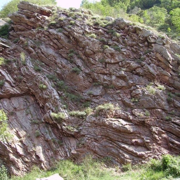
Mica shist as crystalline basement rock of the Dolomites, Arduino’s Primary Rocks.
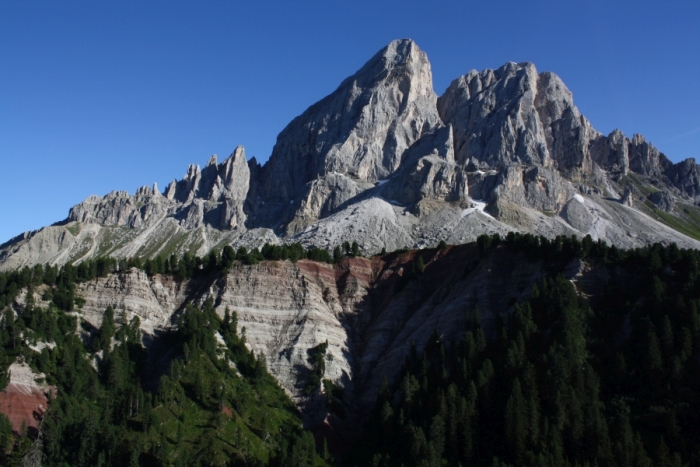
Secondary Layer: A well-stratified succession of marl- and calcareous rocks with marine fossils, making up the characteristic peaks of the Dolomites. In 1841, English geologist John Phillips, based on the correlation of fossils in rock strata worldwide, renamed this sedimentary succession the Mesozoic Era (252 to 66 million years ago).
Sas de Pütia showing Arduino’s Secondary Rocks, the well-stratified red Gröden-Sandstone, grey Bellerophon limestone and fossil-rich reef limestone.
Tertiary Layer: Poorly consolidated sediments like gravel, clay, fossiliferous sand, and also younger volcanic rocks. Our modern Cenozoic Era (66 to 2 million years ago).
A conglomerate of the Tagliamento catchment, dating into the Pleistocene to Miocene according to our modern stratigraphic system (2-23 million years). Similar deposits were Arduino’s Tertiary Rocks.
Quaternary Layers: Unconsolidated sediments found in valleys. Our modern Quaternary Period (2 million years ago to modern age).
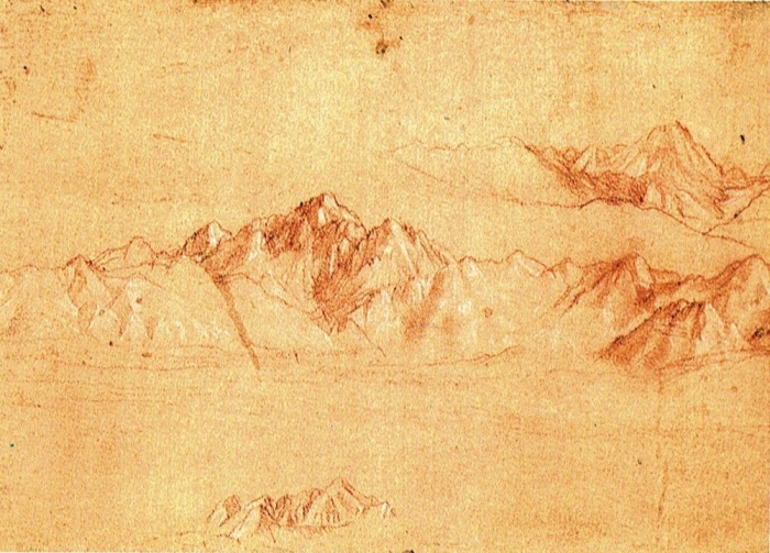
During the Renaissance, the study of common rocks inspired great artists and revolutionized artistic techniques. Italian artist Leonardo da Vinci was one of the first naturalists to both understand the origin of sedimentary rocks and recognize fossils as petrified remains of former living animals. He used his geological insights to improve his paintings and in doing so inspired an entire generation of artists.
The Alps, ca. 1513, red chalk drawing by Leonardo da Vinci. He was fascinated by mountains and called them the “bones of the earth.”
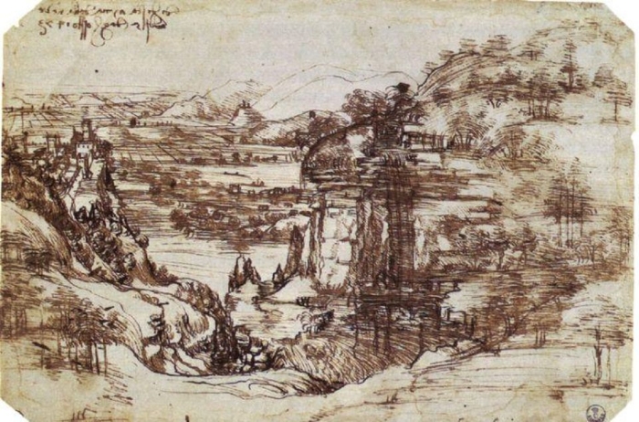
This approach can be seen in da Vinci´s earliest recognized works, dating to 1473. In „The Hills of Tuscany“ or „Landscape with River“, we are apparently standing on the borders of the Apennines, looking down onto a waterfall and the larger valley of the Arno.
The layers of the earth, visible above the waterfall, are depicted in a geologically correct way – thin at the bottom and thick on the top, like the Turbidite sequences found in the Apennines. Together with the lines used to draw the cultivated fields in the Arno valley, the sedimentary layers help to create an three-dimensional effect giving to this landscape a realistic „depth.“ This effect is also helped by the waterfall, which is shown flowing away from the observer in a hydrologically correct manner down the slopes of the mountains into the Arno valley.
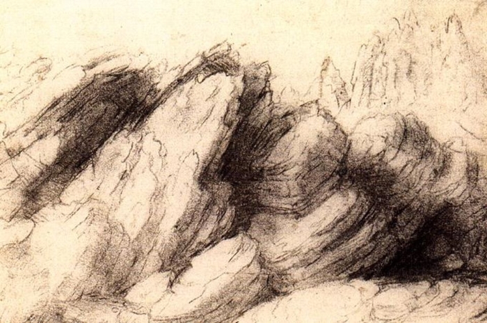
Leonardo da Vinci’s sketch of an outcrop.
Outcrop with sedimentary layers as spotted in the Apennines.
Leonardo’s technique was soon adopted by other artists. German painter Albrecht Dürer visited Italy twice to study the perspectival paintings of contemporary Italian architects and artists. Traveling back home, he tried to apply this revolutionary method to his own paintings. One of his drawings shows a quarry, maybe somewhere near his hometown of Nürnberg, displaying horizontal layers of sandstone and thinner layers of marl in a manner similar to da Vinci’s. Using the tectonic fractures as vertical construction lines, Dürer tried here to subdivide the picture like da Vinci and create the illusion of depth along the steep cliff.
„The Quarry“ by Albrecht Dürer, probably painted in 1495.
Despite never really completely mastering the geometrical rules necessary to create a perfect perspective in a painting, Dürer nevertheless popularized this new technique in Europe. Soon, many other artists followed and began painting realistic landscapes, even studying rocks in order to correctly depict them in their art.
References:
ROSENBERG, G.D. (2009): The measure of man and landscape in the Renaissance and Scientific Revolution. In Rosenberg, G.D., ed., The Revolution in Geology from the Renaissance to the Enlightenment: Geological Society of America Memoir 203: 13-40
Scottish Maria Matilda Ogilvie Gordon (1864-1939), or May as she was called, was the oldest daughter of a pastoral family composed of eight children, five boys and three girls. Maria Ogilvie entered Merchant Company Schools‘ Ladies College in Edinburgh at the age of nine. Already in these early years, she showed a profound interest in nature. During holidays she enjoyed exploring the landscape of the Scottish Highlands accompanied by her elder brother, the later geologist Sir Francis Ogilvie. Maria Ogilvie aspired to become a musician and at age of eighteen she went to London to study music, becoming a promising pianist. Already in the first year her interests shifted towards the natural world and she went for a career in science.
Studying both in London and Edinburgh she obtained her degree in geology, botany and zoology in 1890. Maria Ogilvie hoped to follow-up their studies in Germany, but in 1891, despite a recommendation even by famous geologist Baron Ferdinand Freiherr von Richthofen (famous for describing the fossil reefs in the Dolomites), she was rejected at the University of Berlin – women were still not permitted to enroll for higher education in England and Germany. She went to Munich, where she was welcomed friendly by paleontologist Karl von Zittel (1839-1904) and zoologist Richard von Hertwig (1850-1927). However, she was not allowed to join male students. Sitting in a separate room she listened through the half-open doors to the lectures.
In July 1891, Richthofen invited her to join a five-week trip to the nearby Dolomites Mountains, visiting the Gröden-Valley. From the very first day, Maria Ogilvie was immensely impressed by the landscape and learned rock climbing to better explore the mountains. Richthofen introduced Maria Ogilvie to alpine geology and they visited the pastures of Stuores in the Gader-Valley. At the time Maria Ogilvie was studying modern corals to become a zoologist, but Richthofen, showing her the beautifully preserved fossil corals found here in outcrops of Triassic sediments, convinced her to try a geological career.
The Stuores pastures with fossil-rich marls.
Richthofen was over sixty years old and therefore he couldn’t provide much support in the field. In later years Maria Ogilvie remembers the challenge and danger of fieldwork, sometimes accompanied by a local rock climber named Josef Kostner:
» When I began my fieldwork, I was not under the eye of any Professor. There was no one to include me in his official round of visits among the young geologists in the field, and to subject my maps and sections to tough criticism on the ground. The lack of supervision at the outset was undoubtedly a serious handicap. «
For two summers she hiked, climbed and studied various areas in the Dolomites and instructed local collectors to carefully record and describe their fossil sites. In 1893 she published „Contributions to the geology of the Wengen and St. Cassian Strata in southern Tyrol“. In the paper she included detailed figures of the landscape, geological maps and stratigraphic charts of the Dolomites, establishing fossil marker horizons and describing the ecology of various fossil corals associations. She described 345 species from the today 1.400 known species of mollusks and corals of the local Wengen- and St. Cassian-Formations. This paper, a summary of her thesis „The geology of the Wengen and Saint Cassian Strata in southern Tyrol“, finally earned her some respect by the scientific community. In 1893 she became the first female doctor of science in the United Kingdom. The same year she returned into the Dolomites to continue with her geological and paleontological research. In 1894 she published the important „Coral in the Dolomites of South Tyrol.“ Maria Ogilvie argued that the systematic classification of corals must be based on microscopic examination and characteristics, not as usually done at the time, on superficial similarities.
In 1895 she returned to Aberdeen, where she married a longstanding admirer. Dr. John Gordon respected and encouraged her passion for the Dolomites. He and their four children accompanied Maria Ogilvie on various excursions into the Dolomites. In 1900 she returned to Munich, becoming the first woman to obtain a Ph.D. She helped her old mentor, paleontologist von Zittel, to translate his extensive German research on the „Geschichte der Geologie und Palaeontologie“ – „The History of Geology and Palaeontology.“
Maria Ogilvie continued her studies and continued to publish. In 1913 she was preparing another important work about the geology and geomorphology of the Dolomites, to be published in Germany, but in 1914 with the onset of World War I. and the death of her publisher, the finished maps, plates and manuscripts were lost in the general chaos. In 1922 she returned into the Dolomites, where she encountered the young paleontologist Julius Pia, who, during the war, had carried out research in the Dolomites. Together they explored the mountains, searching for fossils.
Apart from scientific papers, Maria Matilda published also one of the first examples of geological guide books for the Dolomites. To honor her contributions in 2000 a new fossil fern genus, discovered in Triassic sediments, was named Gordonopteris lorigae.
References:
WACHTLER, M. & BUREK, C.V. (2007): Maria Matilda Ogilvie Gordon (1864-1939): a Scottish researcher in the Alps. In BUREK, C. V. & HIGGS, B. (eds): The Role of Women in the History of Geology. Geological Society: 305-317
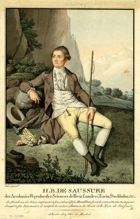
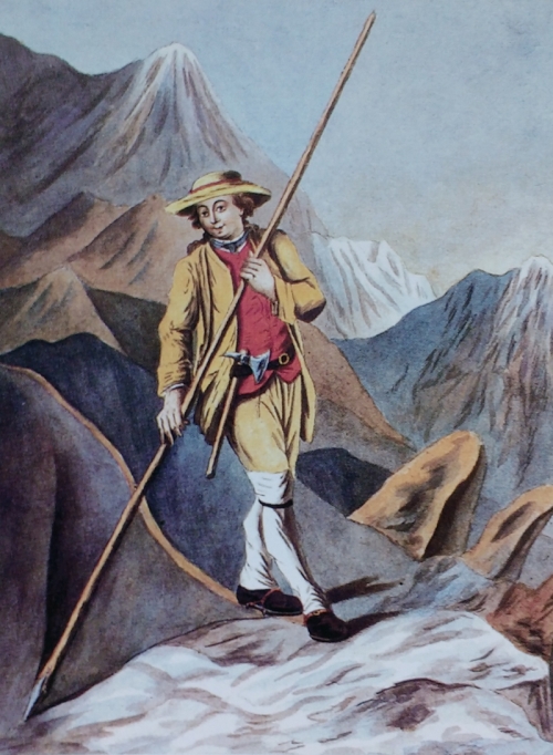
Swiss professor of philosophy Horace-Bénédict de Saussure (1740-1799) was one of the first naturalists to collect observations and measurements in the field. He did so by traveling the Alps and climbing various mountains, among others the Mont Blanc, with 4.810 meter the highest peak of the Alps. During his ascent, he recorded the physiological reactions of his body to the increased elevation, measured air temperature and described the rocks which compose the mountain. One of De Saussure’s guides onto the peak of Mont Blanc was Jacques Balmat, a local chamois hunter and Strahler. A strahler is a crystal seeker, so named after the Strahlen, the shining quartz crystals. The granite of Mont Blanc is famous for its Alpine-type fissures, hosting sometimes spectacular crystals.
The crystal seeker Jacques Balmat, painting by Henry Lévèque.
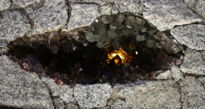
Reconstruction of an Alpine fissure in Mont Blanc granite, with quartz, flourite and chlorite crystals.
Most common are gash fractures formed during the Alpine orogenesis some 25 to 15 million years ago. Below 500°C rocks like gneiss, schist and amphibolite tend to react brittle to tectonic deformation. Permeable to circulating fluids, in the open fissures and at temperatures of 600 to 100°C crystals will start to grow.
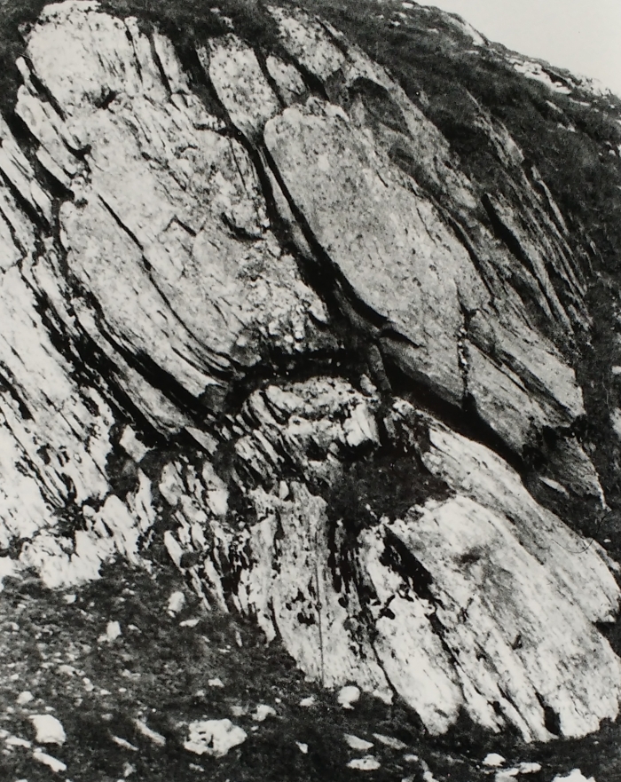
Kluft – an Alpine-type fissure in the field. from „Mineralklüfte und Strahler der Surselva“ by Flurin Maissen (1950). A stiff layer will tend to deform, flattened and stretched to the point that it „necked“, opening a gash fracture between boudins. Thin layers will wrap around this point, partially forming quartz veins. More deformed, the layers will tend to weather more easily.
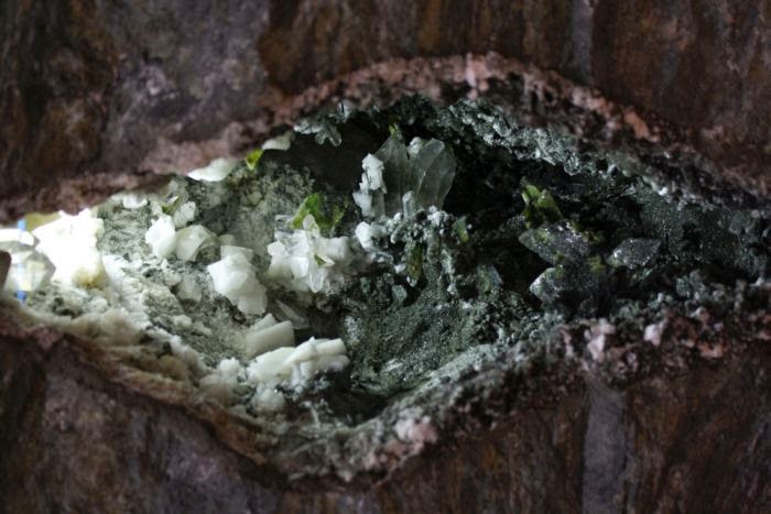
Almost 80% of the Alpine-type minerals comprise feldspar, chlorite, calcite, and quartz. Typical Alpine-type minerals are actinolite, apatite, dolomite, epidote, flourite, hematite, titanite, rutile and zeolithe – more than 140 minerals are known from Alpine-type fissures found in the Eastern Alps.
Alpine-type fissure in greenschist with a typical mineral paragenesis of adularia , quartz and chlorite.
The valley of Vajont (or Vaiont) in the Italian Dolomites is characterized in the upper part by a broad catchment area, carved by ancient glaciers, and in the lower part by a deep and narrow gorge, eroded into limestone formations by the river Vajont. This peculiar shape made the valley a perfect site for a dam and a hydroelectric power station nearby.
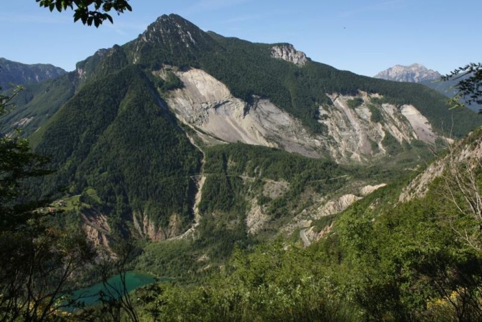
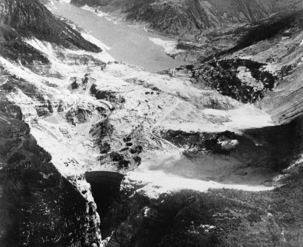
View of Mount Toc with the landslide of Vajont. The small lake on the left is what remains of the reservoir.
History:
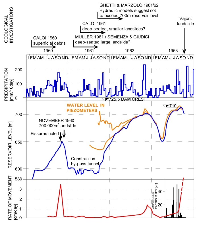
Construction of the Vajont dam started in 1956 and was completed in 1960. At the time it was the highest double-curvature arch dam in the world, rising 261,6 meters above the valley floor and with a capacity of 150 to 168 million cubic-meters. The filling of the reservoir began in February 1960. Eight months later the reservoir was already 170 meters deep. Soon afterward, first fissures were noted on the slopes of Mount Toc, overlooking the Vajont reservoir. On November 4th, with the reservoir 180 meters deep, a first landslide with 700.000 cubic-meters fell into the lake. Alarmed, technicians decided to reduce the filling rate of the reservoir. This strategy was successful until mid 1963, when, between April and May, the depth of the reservoir was rapidly increased from 195 to 230 meters. By July, the depth was 240 meters, another slight increase in the speed of the sliding slope was noted. In early September, when the lake was 245 meters deep, ground movements accelerated to 3,5 centimeters per day. In late September, the water level was lowered in an attempt to slow down slope movements. Even doing so, the ground continued to move at a rate of 20 centimeters per day, enough to open large fissures along the entire flank of Mount Toc. On October 9th, the reservoir’s depth had been lowered almost to 235 meters when the slope began to slide uncontrollable.
Summary of events observed during the filling of the Vajont reservoir. Geological investigations, precipitation, water levels in the reservoir and groundwater levels and rate of movements. The last rise of the reservoir level was accompanied by strong earthquakes coming from the slopes of Mount Toc. Note also how the groundwater level became synchronous with the reservoir level in 1961, suggesting that the previously isolated aquifers in the mountain became connected to the lake.
October 9, 1963, at 10:39 p.m. local time, the entire flank of Mount Toc collapsed. Within 30 to 40 seconds estimated 240-270 million cubic-meters of soil and bedrock slipped into the reservoir, containing 115 million cubic-meters of water at the time. The reservoir was partially filled up by and buried by a 400 meters thick packet of rocks. The landslide pushed part of the water out of the lake, generating a wave with a maximal height of 230-240 meters. In the villages surrounding the reservoir – Erto, Casso, San Martino, Pineda, Spesse, Patata, Cristo, and Frasein – the wave claimed 160 victims. A 100-150 meters high wave rushed into the gorge of the Vajont, in direction of the densely populated Piave valley. There the wave destroyed the town of Longarone and the villages of Pirago, Villanova, Rivalta, and Fae. In less than 15 minutes more than 1.900 people were killed.
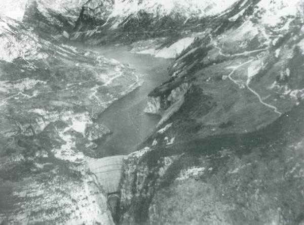
Aerial photo of the Vajont site before and after the landslide (SEMENZA 1964).
Geological Surveys:
For more than three years, the movements were monitored and various geologists studied the creeping slope. Shear zones with crushed rocks were discovered during the construction of a tunnel deep inside the mountain. Some geologists warned of a deep-seated landslide, like Austrian engineer Leopold Müller in 1960 and later Italian geologists Eduardo Semenza and Franco Giudici. In July 1964, Semenza, son of the engineer who planned the dam, recognized that the valley of Vayont is partially filled by old mass-movements deposits and gravels of a landslide-dammed lake, suggesting that catastrophic landslides already happened here.
But other geologists proposed superficial sliding planes, able to cause only small landslides. Small landslides, as happened in 1960, were always expected during the filling of the reservoir. In 1961, the construction of a by-pass tunnel was started, just in case the reservoir would become partially obstructed by a landslide. In the same year, calculations, based on a model of the entire reservoir, suggested that a (small) landslide into the lake could generate a 30 meter high wave. Technicians recommended to not exceed a water level of 700 meters a.s.l. – 25 meters beneath the dam crest – surpassed, however, in 1963 by 10 meters.
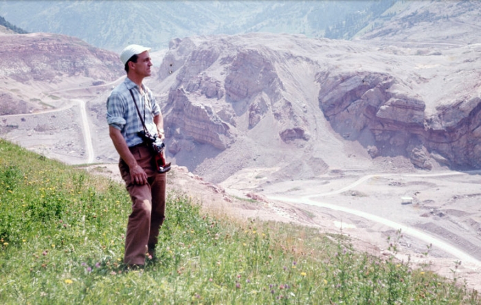
Eduardo Semenza in July 1964, the geologist, son of the engineer who planned the dam, was one of the first to recognize that prehistoric landslide deposits and gravel of landslide-dammed lakes filled the Vajont valley. In the background shattered bedrock of the 1963 event.
Geology:
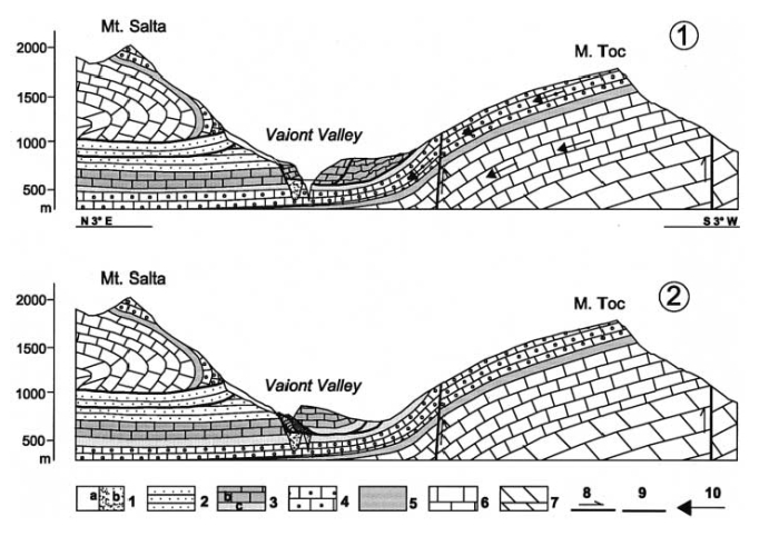
The valley of Vajont is characterized by a succession of Jurassic/Cretaceous to Eocene marl and limestone-formations, forming a large fold, with the valley following the axis of the fold. Sedimentary layers found along the slopes of the mountains, especially on Mount Toc, plunge towards the valley, forming possible sliding planes for a mass movement.
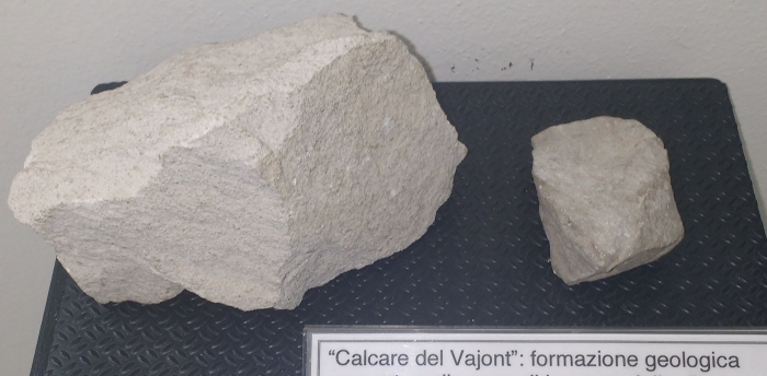
Calcare del Vajont – limestone from the Vajont site. In similar geological formations thin layers of clay can be found. If wet, such layers form perfect sliding planes.
After the disaster, geologists discovered thin layers of green claystone (5-10 centimeters thick) in the limestone of theVajont site. The clay layers acted as sliding planes for a prehistoric landslide and were reactivated by the rising water level in the reservoir.
Two N-S geological sections from Monte Toc to Monte Salta before 9 October 1963 and after. 1a Quaternary; b stratified alluvial gravels; 2 Scaglia Rossa (Upper Cretaceous– Lower Paleocene); 3 Cretaceous-Jurassic Formations (Socchér Formation sensu lato and coeval): b Socchér Formation sensu stricto; c Ammonitico Rosso and Fonzaso Formation; 4 Calcare del Vaiont (Dogger); 5 Igne Formation (Upper Liassic); 6 Soverzene Formation (Lower and Middle Liassic); 7 Dolomia Principale (Upper Triassic); 8 faults and overthrusts; 9 failure surfaces of landslides; 10 direction of water flow into aquifers (from SEMENZA et al. 2000).
Conclusion:
The continuous rejection of the worst-case scenario by authorities and the electric power company, running the dam, was, in part, based on a lack of understanding of large mass movements at the time. Only a few geologists and engineers imagined that an entire flank of a mountain could collapse.
But likely the most important factor contributing to the catastrophe was of financial nature. The Vajont reservoir was an important economic investment, providing energy to nearby large cities and industries, and many politicians supported its construction. Nobody wanted to abandon the entire project until it was too late.
References:
SEMENZA E. (1965): Sintesi degli studi geologici sulla frana del Vajont dal 1959 al 1964. Museo tridentino di scienze naturali, Trento Vol. 16(1): 51
SEMENZA, E. (2005): La storia del Vajont raccontata dal geologo che ha scoperto la frana. K-Flash editore: 280
SEMENZA, E. & GHIROTTI, M. (2000): History of the 1963 Vaiont slide: the importance of geological factors. Bull Eng Geol Env 59: 87–97
“And how will you explain to me the fact of the pebbles being struck together and lying in layers at different altitudes upon the high mountains.”
Leonardo da Vinci, 1508.
The Alps, ca. 1513, red chalk drawing by Leonardo da Vinci. He was fascinated by mountains and called them the „bones of the earth.“
The Conglomerato della Marmolada is a volcaniclastic succession consisting of conglomerates and sandstones accumulated in the basinal area comprised among the lower Ladinian carbonate platforms of the Dolomites.
The period between the fall of the Roman Empire and the Renaissance in the 17th century is sometimes referred to as the Middle or Dark Ages. Used nowadays often as a derogative term, it reflects more our poor understanding of those times then a real cultural demise.
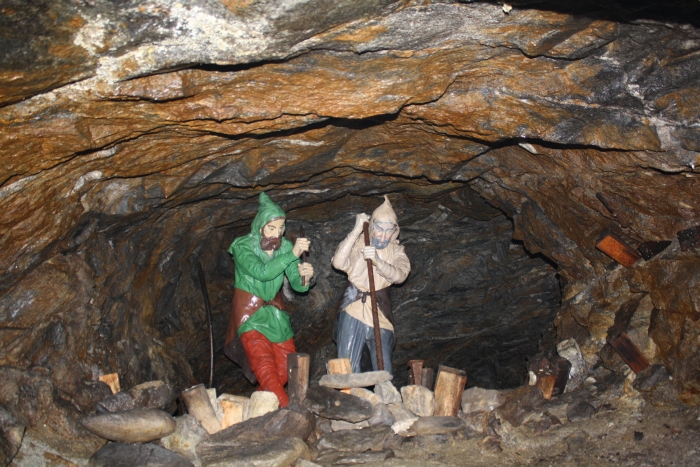
In ancient times the Alps, especially the alpine pastures and rocky outcrops above the tree line, were referred to as Gamsgebirg – the chamois mountains. Only shepherds, collectors of plants and minerals and chamois hunters visited this area and maybe sometimes climbed a mountain. However, in the Middle Ages, rich ore deposits were discovered in the Alps. Schwaz in Tyrol, Schneeberg and Prettau in South Tyrol were famous for the silver and copper mined between the Alpine peaks.
Mining for metals in the Alps dates back at least for 4.800 years (a 25-meter long gallery in North Tyrol was dated to 2.800 BCE). In South Tyrol slag remains were dated to 1.200-1.000 BCE. Slag remains found in Ahrntal possibly date back to the early and middle bronze age (3.300-1.800 BCE), even if the provenance of the used copper ore is unknown. The extraction of copper ore in the Ahrntal became important in medieval times, especially in the 15th century. At the time prospectors were searching for former copper mines and also used geological clues to find new ore deposits. There was likely a lot of empirical knowledge of minerals and rocks to be found between prospectors and miners. Unfortunately, most of this knowledge wasn’t written down. Some evidence for this „lost wisdom“ can be found in traces left by the miners.
Ore veins in Rülein von Calw „Bergbüchlein,“ 1500.
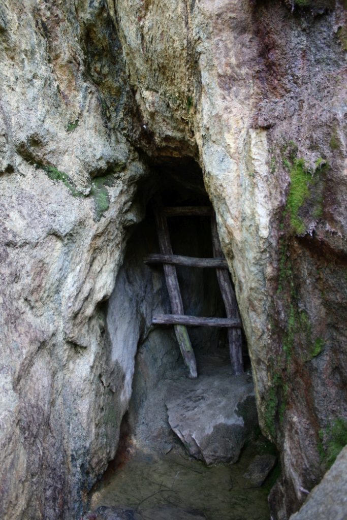
Some basic understanding of the geometry of ore veins was necessary to follow them in the mountain, and some basic understanding of rock quality was necessary to dig the galleries. Advancement was limited to millimeters for every work shift, maybe 5 millimeters per day in hard rock, 5 centimeters if the rock was fractured and soft. Many medieval mines follow fault systems inside the mountain, where the shattered rocks were more easy to excavate. Depending on the encountered rock, the section of the gallery was different. In soft rocks the gallery has a narrow section, pointed roof to better distribute the weight or is reinforced with wooden structures. In hard rocks, the gallery has a flat roof and a larger section.
Reconstruction of miners using a large joint to their advantage.
Medieval gallery in hard rock with flat roof and wide section.
The modern name of important minerals, like feldspar, derives from terms used by the miners. „Feld“ is an old name for hard rocks and „spat“ referred to any rock or mineral that if stroked by a hammer forms plain fracture surfaces.
First written records appear in the 16th century. Georgius Agricola (1494-1555) published in 1556 together with the miner Blasius Weffringer his De re metallica libri XII. In his „twelve volumes about metals,“ he describes various ways to find hidden ore veins. Strange smelling water, springs with unusual deposits of red clay, colored spots of minerals on rocks, disturbed soil cover and crippled plants may indicate ore deposits hidden underground. In his De ortu et causis subterraneorum (1546) he briefly discusses the formation of mountains, by fire, water and wind. Erosion by water forms gorges, then canyons and finally separated mountain ranges. Wind and fire, in the form of volcanism and geothermal activity, play a major role in dismantling (volcanic) mountains.
Later authors, like cartographer Sebastian Münster (1489-1552), cartographer Johannes Stumpf (1500-1566), naturalist Conrad Gessner (1516-1565) and especially naturalist Johann Jakob Scheuchzer (1672-1733), describe mountains in great details, including plants, animals and rocks. However, few provide an explanation for their formation. Scheuchzer depicts and describes folds in the Swiss Alps, explaining them as layers deposited and then folded by the biblical flood. Italian author Valerius Faventies publishes in 1561 De montium origine, wherein he collects all the contemporary theories explaining the formation of mountains. An important role was given to celestial forces, causing rock and minerals to grow and expand inside Earth.
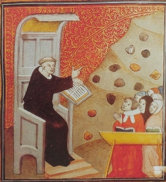
Lecture in mineralogy, from „De nuptiis Philologiae et Mercurii“, 17th century.
Literatur:
LEFEVRE, W. (2010): Picturing the world of mining in the Renaissance: The Schwazer Bergbuch (1556). Max-Planck-Institut für Wissenschaftsgeschichte