» [I worked] still young in the mines of Klausen and elsewhere in Tyrol, in order to learn Metallurgy; I went there by chance, and I was urged to stay by my natural very strong inclination for the universal Mineralogy, and for all the matters concerning the Science of the Fossil Kingdom. «
Venetian scientist Giovanni Arduino worked at an early age as a mining assistant in the iron mines of Klausen in South Tyrol.
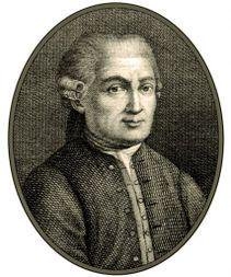
Italian mining engineer Giovanni Arduino (1714-1795) is considered nowadays the spiritual father of the modern chronostratigraphic chart. Based on his observations in the Venetian Dolomites and Tuscany in 1759 Arduino proposed „a series of layers forming the visible crust of earth … “ subdivided „in four generalized units following each other.“ He named them primary, secondary, tertiary, and quaternary, speculating that they formed at various times and under different environments.
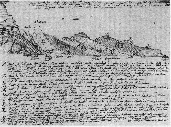
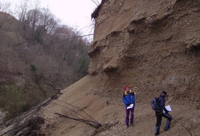
Arduino used a section of rocks exposed in the Val dell´Agno (Venetian Dolomites) to explain his classification. The numbers refer to the thickness of the strata, the letters to the description in the accompanying text. The extremely tattered state of the original drawing suggests that Arduino showed it repeatedly to the many naturalists who visited him.
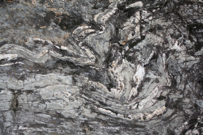
Primary Layer: Pebbles formed by the erosion of underlying “primitive or primeval” – considered to be the earliest – rocks. Fossils were rare, if not absent. This unit includes unstratified or poorly stratified rocks, like porphyry, granite and schist, of the crystalline basement of the Dolomites. Arduino’s rock unit survives into modern chronostratigraphic charts as the Paleozoic Era (rocks older than 252 million years) and Precambrian Eon (541 million years to about 4.6 billion years ago).
Mica shist as crystalline basement rock of the Dolomites, Arduino’s Primary Rocks.
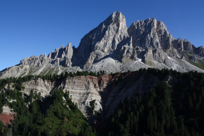
Secondary Layer: A well-stratified succession of marl- and calcareous rocks with marine fossils, making up the characteristic peaks of the Dolomites. In 1841, English geologist John Phillips, based on the correlation of fossils in rock strata worldwide, renamed this sedimentary succession the Mesozoic Era (252 to 66 million years ago).
Sas de Pütia showing Arduino’s Secondary Rocks, the well-stratified red Gröden-Sandstone, grey Bellerophon limestone and fossil-rich reef limestone.
Tertiary Layer: Poorly consolidated sediments like gravel, clay, fossiliferous sand, and also younger volcanic rocks. Our modern Cenozoic Era (66 to 2 million years ago).
A conglomerate of the Tagliamento catchment, dating into the Pleistocene to Miocene according to our modern stratigraphic system (2-23 million years). Similar deposits were Arduino’s Tertiary Rocks.
Quaternary Layers: Unconsolidated sediments found in valleys. Our modern Quaternary Period (2 million years ago to modern age).
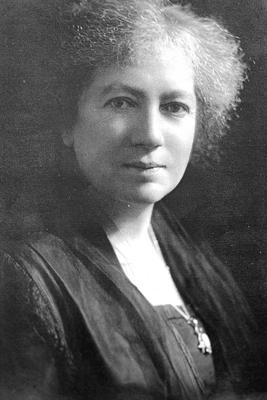
Scottish Maria Matilda Ogilvie Gordon (1864-1939), or May as she was called, was the oldest daughter of a pastoral family composed of eight children, five boys and three girls. Maria Ogilvie entered Merchant Company Schools‘ Ladies College in Edinburgh at the age of nine. Already in these early years, she showed a profound interest in nature. During holidays she enjoyed exploring the landscape of the Scottish Highlands accompanied by her elder brother, the later geologist Sir Francis Ogilvie. Maria Ogilvie aspired to become a musician and at age of eighteen she went to London to study music, becoming a promising pianist. Already in the first year her interests shifted towards the natural world and she went for a career in science.
Studying both in London and Edinburgh she obtained her degree in geology, botany and zoology in 1890. Maria Ogilvie hoped to follow-up their studies in Germany, but in 1891, despite a recommendation even by famous geologist Baron Ferdinand Freiherr von Richthofen (famous for describing the fossil reefs in the Dolomites), she was rejected at the University of Berlin – women were still not permitted to enroll for higher education in England and Germany. She went to Munich, where she was welcomed friendly by paleontologist Karl von Zittel (1839-1904) and zoologist Richard von Hertwig (1850-1927). However, she was not allowed to join male students. Sitting in a separate room she listened through the half-open doors to the lectures.
In July 1891, Richthofen invited her to join a five-week trip to the nearby Dolomites Mountains, visiting the Gröden-Valley. From the very first day, Maria Ogilvie was immensely impressed by the landscape and learned rock climbing to better explore the mountains. Richthofen introduced Maria Ogilvie to alpine geology and they visited the pastures of Stuores in the Gader-Valley. At the time Maria Ogilvie was studying modern corals to become a zoologist, but Richthofen, showing her the beautifully preserved fossil corals found here in outcrops of Triassic sediments, convinced her to try a geological career.
The Stuores pastures with fossil-rich marls.
Richthofen was over sixty years old and therefore he couldn’t provide much support in the field. In later years Maria Ogilvie remembers the challenge and danger of fieldwork, sometimes accompanied by a local rock climber named Josef Kostner:
» When I began my fieldwork, I was not under the eye of any Professor. There was no one to include me in his official round of visits among the young geologists in the field, and to subject my maps and sections to tough criticism on the ground. The lack of supervision at the outset was undoubtedly a serious handicap. «
For two summers she hiked, climbed and studied various areas in the Dolomites and instructed local collectors to carefully record and describe their fossil sites. In 1893 she published „Contributions to the geology of the Wengen and St. Cassian Strata in southern Tyrol“. In the paper she included detailed figures of the landscape, geological maps and stratigraphic charts of the Dolomites, establishing fossil marker horizons and describing the ecology of various fossil corals associations. She described 345 species from the today 1.400 known species of mollusks and corals of the local Wengen- and St. Cassian-Formations. This paper, a summary of her thesis „The geology of the Wengen and Saint Cassian Strata in southern Tyrol“, finally earned her some respect by the scientific community. In 1893 she became the first female doctor of science in the United Kingdom. The same year she returned into the Dolomites to continue with her geological and paleontological research. In 1894 she published the important „Coral in the Dolomites of South Tyrol.“ Maria Ogilvie argued that the systematic classification of corals must be based on microscopic examination and characteristics, not as usually done at the time, on superficial similarities.
In 1895 she returned to Aberdeen, where she married a longstanding admirer. Dr. John Gordon respected and encouraged her passion for the Dolomites. He and their four children accompanied Maria Ogilvie on various excursions into the Dolomites. In 1900 she returned to Munich, becoming the first woman to obtain a Ph.D. She helped her old mentor, paleontologist von Zittel, to translate his extensive German research on the „Geschichte der Geologie und Palaeontologie“ – „The History of Geology and Palaeontology.“
Maria Ogilvie continued her studies and continued to publish. In 1913 she was preparing another important work about the geology and geomorphology of the Dolomites, to be published in Germany, but in 1914 with the onset of World War I. and the death of her publisher, the finished maps, plates and manuscripts were lost in the general chaos. In 1922 she returned into the Dolomites, where she encountered the young paleontologist Julius Pia, who, during the war, had carried out research in the Dolomites. Together they explored the mountains, searching for fossils.
Apart from scientific papers, Maria Matilda published also one of the first examples of geological guide books for the Dolomites. To honor her contributions in 2000 a new fossil fern genus, discovered in Triassic sediments, was named Gordonopteris lorigae.
References:
WACHTLER, M. & BUREK, C.V. (2007): Maria Matilda Ogilvie Gordon (1864-1939): a Scottish researcher in the Alps. In BUREK, C. V. & HIGGS, B. (eds): The Role of Women in the History of Geology. Geological Society: 305-317
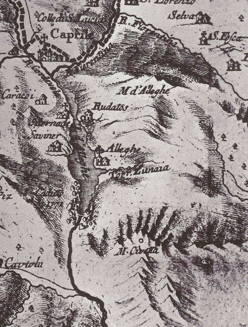
The lake of Alleghe in the Cordévole Valley formed at 7:02 in the morning of January 11, 1771. That day a river flowing through the valley became dammed by a landslide coming from the mountain Piz.
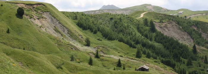
The valley of Cordévole with the village and lake of Alleghe, on the left of the mountain Piz the scar of the landslide is barely visible in the forest, in the background the Civetta (3.220m).
The Alps-traveler and naturalist Belsazar Hacquet (1739-1815) remembers a visit to the lake in 1780:
„The river Cordévole became my guide, by following him I would find the valley of Cadore. However, just after some hundred steps the river was flowing in a large lake, existing here only for the last nine years. I walked around in eastern direction, leaving the villages of Sternade and Saviner behind me, until I arrived at the base of the mountain of Piz. First the lake was narrow, only near Saviner it became more than 100 Venetian fathom [an old length unit used in the mining industry of these times, one fathom ca. 1,8 meter] wide and more than thirty deep.
The last mentioned village once was situated on a hill, and in the valley there were four smaller villages …[]… flooded by the lake, …[]… [the village] Marin, was buried with the village of Riete beneath the collapsing mountain of Piz, the last described village located previously on the top of the mountain.
Standing on the top of the mountain, I immediately noted that the mountain has a volcano on top of it, and it was possible to see how deep [its volcanic dikes] went. After the mountain collapsed, it could be seen that its base was composed of limestone, build up by mighty layers, dipping from west to east with a 45 degrees angle. The [slip] surface of the landslide is so smooth, that a man has difficulties to climb on it to the top of the mountain.„
The strange notion by Hacquet of an active volcano in the Dolomites is based maybe on his discovery of volcanic rocks in the area, however – as we today know – these volcanic deposits are more than 235-million-years-old. At the time of Hacquet’s geologic investigation, volcanic forces were believed to cause strong and sudden movements of Earth, explaining sudden disasters like a landslide.
The landslide of Alleghe killed 48 people and destroyed parts of the village of Riete and some farms. Water levels in the landslide-lake continued to rise over the next weeks, inundating the village of Peron. Only in February 1771, a new outflow formed, stabilizing water levels and creating the modern lake.
Historic depiction of the landslide-lake in the „Atlas Tyrolensis“ of 1774 by Peter Anich and Blasius Hueber. Note the boulders on the southern shore of the lake. Anich and Hueber were the first cartographers to use signatures to display geomorphologic features -like landslides – in their maps.
The French nobleman Diedonnè-Silvain-Guy-Tancrede de Gvalet, born June 23, 1750, in the village of Dolomieu, was a typical naturalist of his time. At the age of 26, de Dolomieu traveled through Europe, got interested in the mines of the Bretagne and the basaltic plateaus in Portugal, visited Italy to study the aftermath of an earthquake and to observe the erupting Mount Etna in Sicily. In 1789 he also visited Tyrol. At the Brenner Pass and between the cities of Bozen and Trento he noted a rock similar to limestone. However, unlike limestone, this rock showed no reaction with acids. He published this observation in July 1791 in a letter to the Journal of Physique. Nicolas Theodore de Saussure, son of famous Swiss alpinist Horace Benedict de Saussure, requested some samples to analyze the chemical composition of this new kind of rock. In 1792, de Saussure published the Analyse de la Dolomie.
Dolomite the mineral.
The first mention of the Dolomites is found in the 1846 book The Horns of the Dolomite Mountains. Later the two alpinists Josiah Gilbert and G.C. Churchill helped to popularize the new name with their mountain climbing guide The Dolomite Mountains, published in 1864. The name Dolomites became popular after 1876, and was oficially adopted for the region after World War I.
Dolomites the mountains.
The geological genesis of the Dolomite Mountains was one of the great mysteries of the world. Fossils provided clues that the rocks composing the mountains were formed once in the sea, but in these early days of geology, almost nothing was known about the bottom of the sea and sedimentation in oceans.
In June 1770 the British explorer James Cook discovered, not entirely voluntarily as his ship the HMS Endeavour collided with it, the Great Barrier Reef of Australia. Here apparently gigantic mountains of limestone were formed by coral polyps and other marine organisms. But how could these mountains rise from the bottom of the sea and form a landscape on dry land?
Section of fossil corals.
Modern coral reef.
In 1772, during the second voyage of Cook, the German naturalist Georg Forster visited the atolls and volcanic islands of the Pacific Ocean. Forster observed that corals live in the first meters of the sea, but outcrops on land showed that the limestone produced by the coral polyps can be almost 300-600 meters thick. He developed a hypothesis to explain this observation. The corals grow slowly from the bottom of the sea until reaching the surface, where erosion levels the reef to form the plain surface of an atoll, then violent volcanic eruptions push the reef above sea level.
Almost fifty years later, another naturalist became intrigued by the mysterious connection between volcanoes, corals and atolls. During his voyage on board HMS Beagle, a young geologist named Charles R. Darwin studied Lyell’s Principles of Geology and the chapter about reefs in the Pacific stimulated his imagination. In February 1835, Darwin experienced a powerful earthquake in Chile and shortly afterward noted evidence of several meters of uplift in the region. According to Lyell’s view, Darwin imagined that mountains could rise and sink over time. Based only on the description in the book of atolls and assuming slow movements of the surface of the Earth, Darwin developed a preliminary hypothesis to explain the formation of atolls in the middle of the sea.
„No other work of mine was begun in so deductive a spirit as this; for the whole theory was thought out on the west coast of S. America before I had seen a true coral reef. I had therefore only to verify and extend my views by a careful examination of living reefs. But it should be observed that I had during the two previous years been incessantly attending to the effects on the shores of S. America of the intermittent elevation of the land, together with the denudation and deposition of sediment. This necessarily led me to reflect much on the effects of subsidence, and it was easy to replace in imagination the continued deposition of sediment by the upward growth of coral. To do this was to form my theory of the formation of barrier reefs and atolls.“
Darwin recognized that the animals forming the corals needed sunlight, so the corals couldn’t grow on the dark bottom of the sea. He imagined that corals would colonize extinct volcanoes. As the volcanic islands slowly erode they sink into the sea. These movements are slow enough to enable the corals to compensate the subsidence and keep living near the surface of the sea, where plenty of light and nutrients are available. Darwin’s hypothesis was very speculative, based only on superficial observations – there was simply no way to study the shape and base of coral reefs at the time.
American geologist James Dwight Dana, who in 1838-1842 visited the Pacific, confirmed most of the observations of Darwin. Important modifications to the reef-theory were added in 1868, when the German zoologist Carl Semper studied atolls. In 1878 and 1880 the oceanographer John Murray published his observation made during the Challenger-Expedition (1872-1876) on the islands of Palau and the Fijis. He postulated that reefs grow on submarine elevations of any kind if they are high enough, not only volcanoes. This new theory was strongly supported and improved over time by geologists. Atolls grow up from shallow submarine elevations of various origins. Corals in the middle of the reef will die due the reduced circulation of water, then the calcareous skeleton of the reef building organisms is dissolved by the agents of erosion. In the end a lagoon and the characteristic shape of an atoll forms.
Such observations of living reefs in the tropical seas provided new impulses to interpret the geological relationships in the Dolomites. In 1860 the Austrian geologist Baron Ferdinand F. von Richthofen visited and studied the Dolomites. He discovered that the sandstone and tuff deposits, surrounding the isolated peaks of dolostone, contained large limestone boulders, some containing still recognizable fossils of corals. Based on the theory of evolution of a reef as proposed by Darwin, Richthofen suggested that the isolated peaks were the intact remains of an ancient reef, still surrounded by clastic sediments of an ancient basin, in which, from time to time, landslides from the steep slopes of the reef deposited large boulders of corals.
Upper Triassic basinal succession. Notice the gradual transition between the volcanoclastic Wengen Fm (below,darker) and the more carbonatic S. Cassiano Fm. In the background the cliffs of Cassian Dolomite platform.
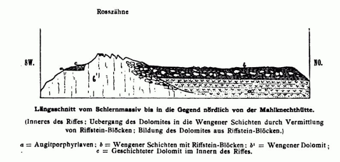
Clinostratification/Slope -bedding in the outer parts of the carbonate platforms of the Dolomites (after MOJSISOVIC 1879). Scheme of bedding on the flanks of carbonate platforms and examples of flank and basin deposits from the Sciliar/Schlern platform. Note the abundant limestone boulders in the basin sediments.
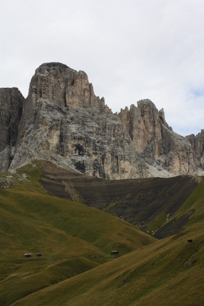
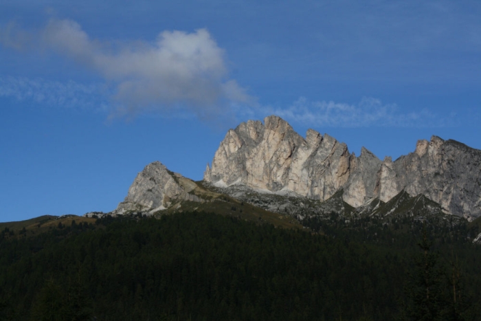
The young geologists Edmund Mojsisovics von Mojsvar developed further this reef hypothesis, mapping in detail the relationships between the single facies, ranging from the lagoon of the atoll to the open sea. Massive, many thousands of meter thick reefs of dolostone changed suddenly to well-bedded carbonates, deposited in a central shallow lagoon. The former slope of the reef was composed of tongues of reef debris interbedded within sandstones, shale and basalts deposited on the bottom of the sea. Such strong sedimentary facies changes were until then considered impossible. The reconstruction of the Dolomites as an ancient atoll landscape seemed so radical, Mojsisovics was forced to find a private publisher for his revolutionary work.
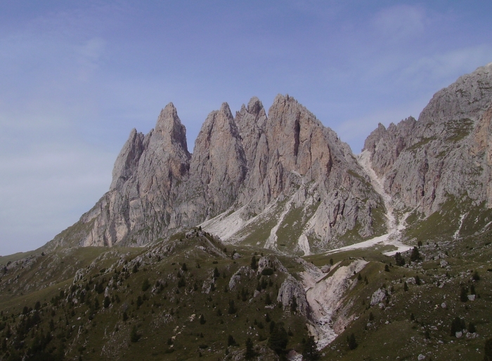
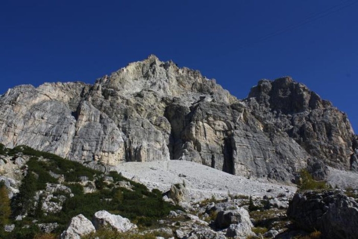
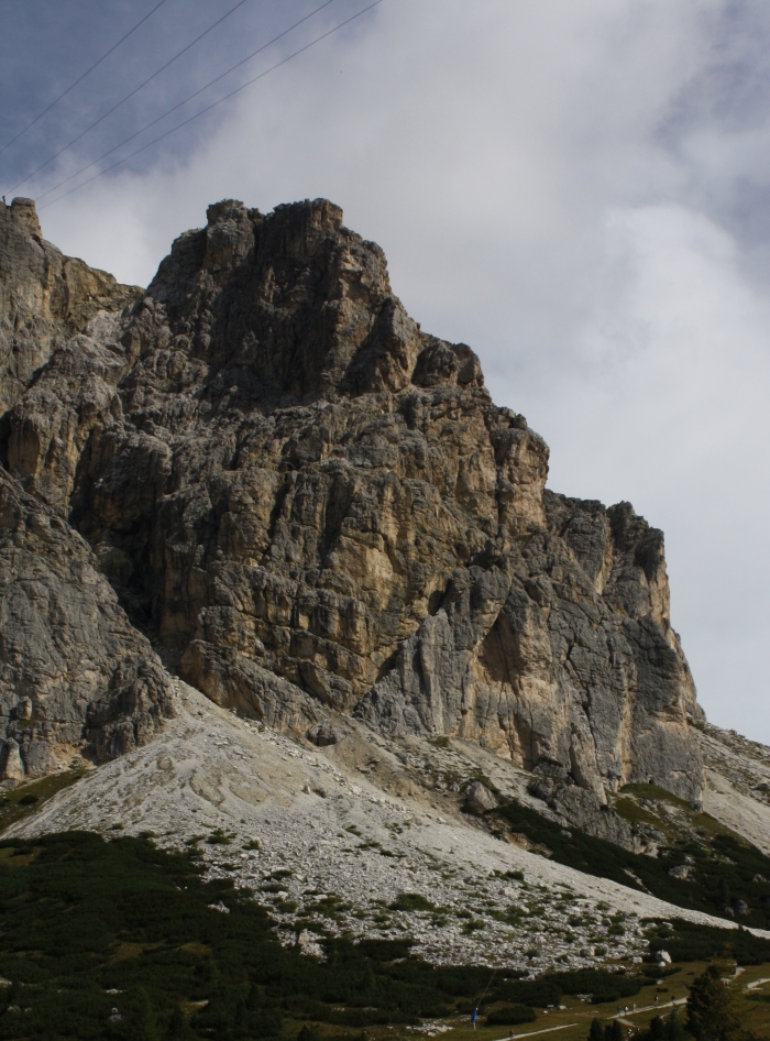
Settsass and Piccolo Settsass, also known as Richthofen-Riff. Here a Triassic reef with clinostratification into basin sediments (St. Kassian-Fm; Wengen-Fm, brown sandstones/shales/marls) is exposed by erosion.
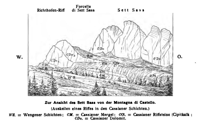
Geological drawing of the Richthofen-Riff. Figure by MOJSISOVICS 1879.
The origin of the Dolomite Mountains as fossil reefs recalls the birth of Venus. Like the ancient goddess of beauty, the Dolomites were born out from the sea.
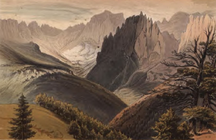
The Rosengarten Group by Josiah Gilbert, from Gilbert & Churchill’s “excursions through Tyrol, Carinthia, Carniola, & Friuli in 1861, 1862, & 1863 including a geological chapter, and pictorial illustrations from original drawings on the spot.”
References:
DOBBS, D. (2005) Reef Madness: Charles Darwin, Alexander Agassiz and the meaning of coral. Pantheon Books: New York
FISCHER, A.G. & GARRISON, R.E. (2009): The role of the Mediterranean region in the development of sedimentary geology: a historical overview. Sedimentology 56: 3-41
SCHLAGER, W. & KEIM, L. (2009): Carbonate platforms in the Dolomites area of the Southern Alps – historic perspectives on progress in sedimentology. Sedimentology 56: 191-204
The Great War (1914-1918), fueled by technological innovations and the industrial revolution, was a new type of war. Every corner of the world was touched, from the sea to the highest peaks of the Alps. Entire landscapes were devastated by high-energy explosives.
The Lagazuoi overlooking the Falzarego-Pass in the Dolomites. During WWI the Austrian front-line followed the crest of the mountain, the Italians occupied the ridge in the middle of the cliff.
May 23, 1915, Italy declares war on Austria-Hungary, bringing the war also into the Dolomites. The Austrian military high command fears that the Italian army now can reach the capital city of Vienna in just a few days, so the local troops are ordered to fortify the most important routes and mountain passes in the region. There was no experience with combat in such an extreme environment. Braced by snow-capped mountains, neither side can find a way to dislodge their enemy.
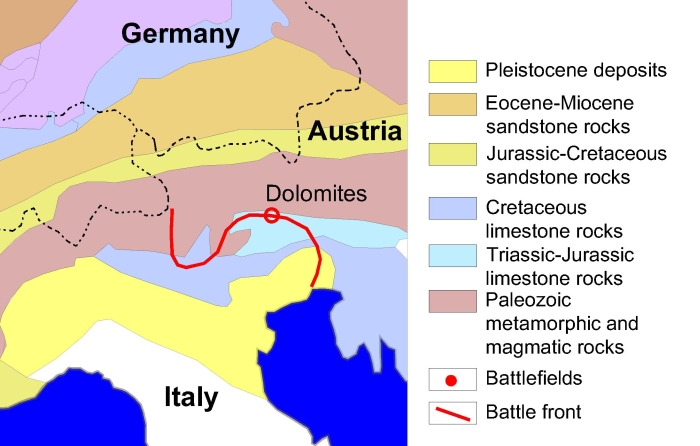
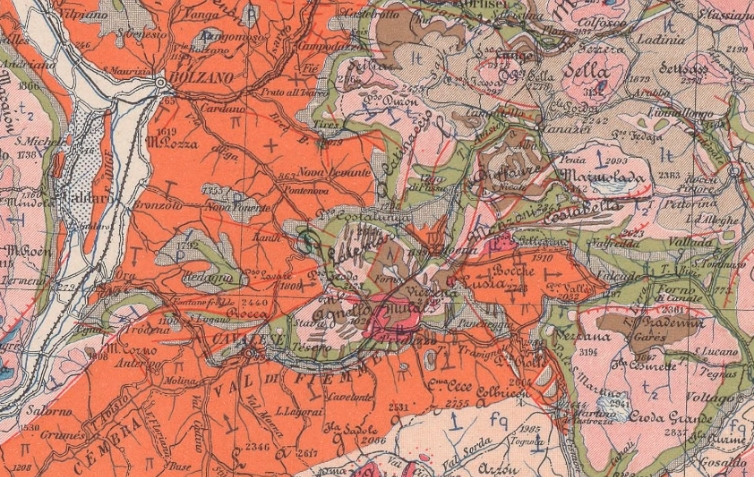
Simplified geological map of the Alps.
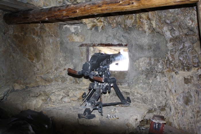
Of strategic importance was the Falzarego-Pass. The nearly vertical cliffs of the Lagazuoi, a 2.835 meter-high mountain, overlook this pass. The Austrian forces fortified the mountain summit, attacked from below by the Italian forces. It was almost impossible to directly attack the enemy, defending himself with machine-gun nests and taking shelter behind rocks. The military tried to solve this problem with tactics first successfully adopted in the plains of France. Tunnel warfare involves the construction of long tunnels beneath the enemy lines, large quantities of explosives are then detonated to form a breach. In the Dolomites, explosions were also used to trigger rockfall and kill the enemy.
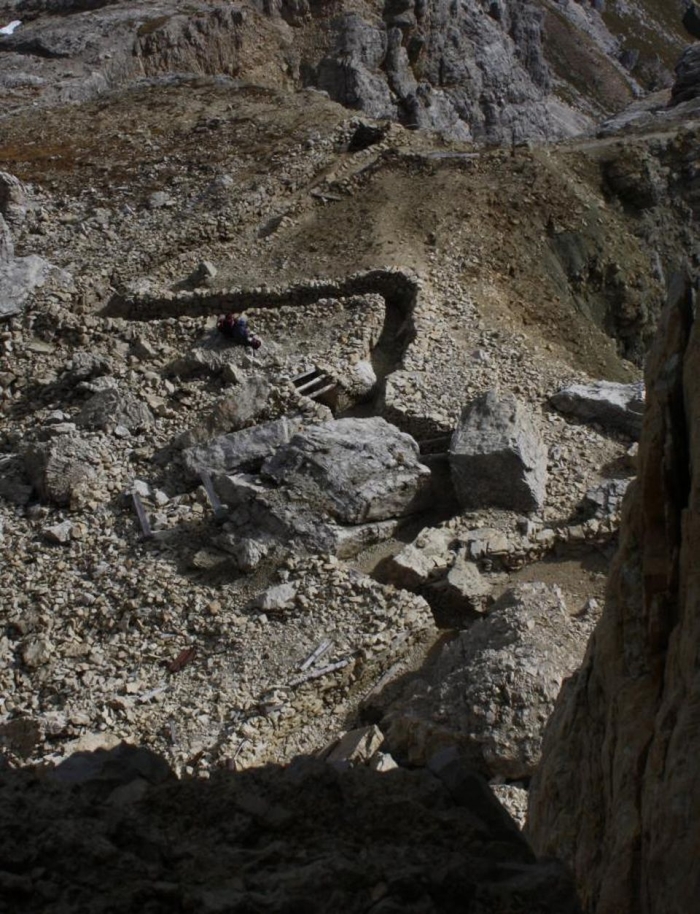
Machine-gun nest overlooking the Lagazuoi, hidden in a cavern built into Cassian-Dolomite.
In July 1916, to reach the Italian position located on a rock ledge (formed by a large fault) on the southern side of the Lagazuoi, the Austrian army started to dig a tunnel from the northern side. Adopting a similar strategy, the Italian army tried to dig a tunnel beneath the peak of the Lagazuoi. The Austrians detonated the first mine on January 14, 1917.
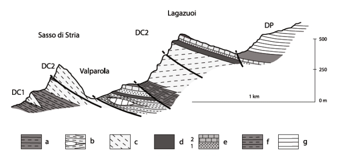
The Lagazuoi is composed of the Cassian-Dolomite, the dolostone core of a former Triassic reef. The relative plain summit of the Lagazuoi is formed by erodible marl deposits of the Heiligkreuz- and Travenanzes-Formation. The Falzarego-Pass and nearby Valparola-Pass are located in the former basin sediments (soft sandstone and marl formations) separating the Lagazuoi reef from nearby carbonate platforms.
Cross-section through the Lagazuoi. a) San Cassiano Fm; b) shallow-water deposits of the San Cassiano Fm; c) Cassian Dolomite; d) Heiligkreuz Fm ; e) Dibona sandstone, (1) lower member of marls, calcarenites and sandstones; (2) upper carbonate beds; f) Travenanzes Fm; g) Dolomia Principale (Trombetta 2011).
The hard dolostone is deformed and broken by tectonic forces. However, the rock was much harder to excavate than expected. Working incessantly the miners were able to advance 9 meters a day. Between 1915 to 1917, when the war in the Dolomites ended, more than 34 such tunnel blasting operations were attempted, 20 by the Italian and 14 by the Austrian military.
WWI trench on the Lagazuoi summit dug into the softer Heiligkreuz- and Travenanzes-Formation.
In 1917, shortly before detonating a mine, the Italian soldier Luigi Panicalli wrote: “I realize that in just some moments the results of all the months of work and suffering will become visible. I’m like petrified. In the last moments my thoughts are by the enemy – poor guys – do they feel death approaching? Do they know, that the enemy is inside the mountain, ready to blast them from the mountain down into their graves?“
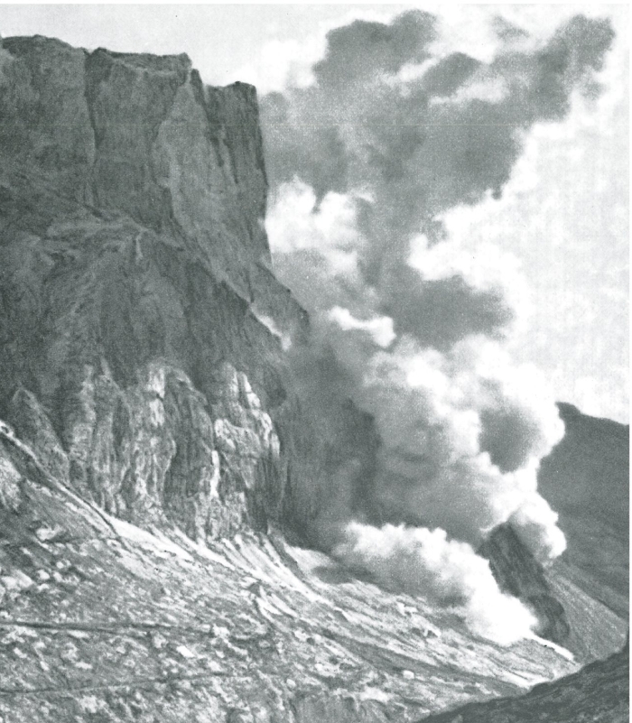
Detonation of a mine on the Lagazuoi by the Italian forces May 22,1917, to dislodge the Austrain forces still occupying the summit. 41 soldiers were killed.
Crater and debris formed by a mine on May 22, 1917.
Crater and debris formed by mine detonation on June 20, 1917.
References:
BREDA, A. et al. (2009): The Carnian Pluvial Event in the Tofane area (Cortina d‘Ampezzo, Dolomites, Italy). Geo.Alp, Vol. 6.: 80–115
HÜSLER, E.E. (2017): Auf alten Kriegspfaden durch die Dolomiten – 30 spektakuläre Wanderungen auf historischen Wegen. Bruckmann Verlag: 158
LANGES, G. (2012): Die Front in Fels und Eis – 1915-1918. Verlagsanstalt Athesia, Bozen: 232
MEDERLE, O. (2016): Auf den Spuren der Tiroler Front – Wanderungen zu den Kriegsschauplätzen 1914 bis 1918. Athesia Verlag: 176
In September 1822, the two German geologists Alexander von Humboldt and Leopold von Buch visited the village of Predazzo in the valley of Fiemme, Italian Dolomites.
Alexander von Humboldt and other famous geologists visited and studied the Dolomites.
This locality was famous among geologists due to a geological mystery found nearby in the volcanic complex of Predazzo and Monzoni.
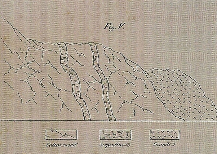
According to Neptunism, a scientific theory very popular at the time among German geologists, all rocks were formed by sedimentation from a primordial sea. Neptunists believed that coarse-grained granite bodies were the first rocks to crystallize, always followed by younger layers of schist and sedimentary rocks. However, near Predazzo a massive granite body covers the layers of limestone and therefore is the younger geological formation. Von Buch explained this puzzling observation as a result of a large landslide, disturbing the order of the rocks, but Humboldt was not convinced by this explanation.
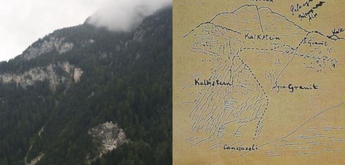
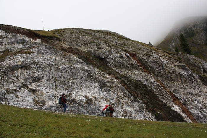
The outcrop above the village of Predazzo today and a sketch from 1849. The limestone-marble („Kalkstein“), also referred to as „predazzite„, surrounds a large intrusive body of „granite“ (a monzonite-syenite). This was impossible according to the prevailing geological theories of the 19th-century, as the crust of the Earth was imagined to consist of ordered layers of various rock-types.
During a five-year long expedition to South America, Humboldt visited and studied many volcanoes. During a stop at the island of Tenerife in June 1799, he climbed the Pico de Teide, the first active volcano Humboldt examined. Humboldt climbed many more volcanoes in the Andes, studied mineral collections and visited mines. He was particularly impressed by the hard work he saw in the silver mines of Peru. Like he did in Germany, the former mining engineer criticized the adopted mining technologies as inadequate, outdated and dangerous for the miners. In November 1801, Humboldt climbed the active volcanoes of Puracé and Paramos of Pasto. Bad weather prevented the ascent to the Galeras. In January 1802, he climbed the Antisana and Cotopaxi, the highest active volcano on Earth. Humboldt climbed and sketched the active Pichincha in Equador. The day after Humboldt’s return, an earthquake hit the nearby city of Quito and Humboldt was suspected of sorcery, awakening the sleeping volcano. Fortunately he was able to convince the locals that the earthquake was not supernatural, but a natural event.
Humboldt returned to Europe in August 1804. A year later he traveled, together with Leopold von Buch and Joseph Louis Gay-Lussac, to Italy. Visiting Naples, the three geologists repeatedly climbed Mount Vesuvius and witnessed the eruption of August 1805.
As a young geology student, Humboldt considered himself a Neptunist. He believed that the fires visible in the crater of an active volcano were fed by large subterranean coal layers. But after observing the active volcanoes in the Andes and Italy, with no coal deposits found nearby, and studying the particular rock types found near Predazzo, Humboldt quickly „converted“ to Plutonism.
Plutonism is named after the Roman god of the underworld. Plutonists believed that volcanism plays a major role in the formtion of rocks. Large chambers of molten magma exist within Earth’s crust. Volcanoes are connected to those magmatic chambers by volcanic conduits and as the magma erupts, it cools quickly and forms the fine-grained lava. If the magma cools slowly, still stuck in the subterranean chambers, it will form an igneous rock with large crystals. Erosion will remove the overlying rocks and expose the crystallized rock as granite. This, so Humboldt, likely happened also near Predazzo.
Basaltic dikes („serpentinite“) cutting through marbles („modified limestone“) in contact with a magmatic intrusion of „granite“. Figure from Geo-Mineralogische Skizzen über einige Täler Tirols, 1848.
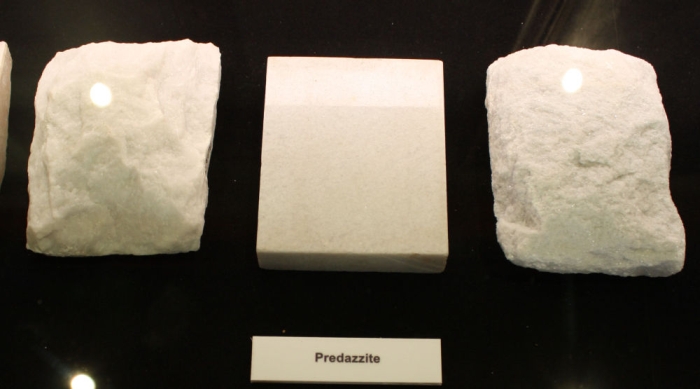
Some 230 million years ago molten magma was injected under great pressure in the older limestone formation, deposited in an ancient sea. The magmatic intrusion and magmatic dikes cut through the limestone, causing the rock succession that baffled 19th-century geologists. Slowly cooling over the ages, the magma solidified and crystallized to form the monzonite-syenite, at the same time the limestone was transformed by the great heat coming from the magma intrusion into predazzite, a sort of marble.
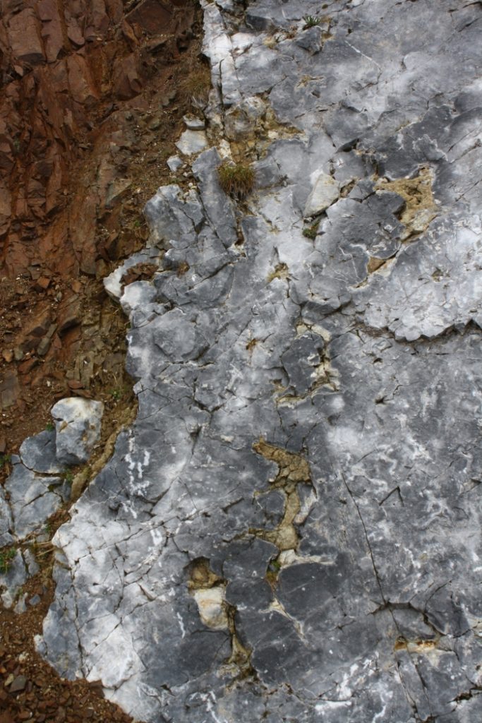
228-237 million years old magmatic dikescutting through marbles (former reef limestone), as seen at the locality of Mountain of Dos Capel near Predazzo.
Contact metamorphism between a basaltic dike and former reef limestone.
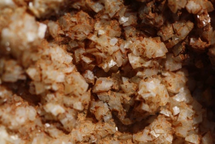
Samples of predazzite – a contact-metamorphic limestone named after the village of Predazzo.
The volcanic rocks of Predazzo are associated with the volcanic system of Monzoni, a large volcano that erupted some 230 million years ago. It is also the type locality of the granite variety monzonite.
References:
AVANZINI, M. & WACHTLER, M. (1999): Dolomiti – La storia di una scoperta. Athesia, Bolzano: 150
DELLANTONIO, E. (1996): Geologia delle Valli di Fiemme e Fassa. Museo Civico „Geologia e Etnografia“ Predazzo: 72