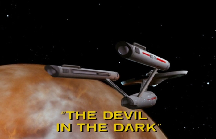
Geological Star Trek Review – “The Devil in the Dark”

The 1967 Star Trek episode “The Devil in the Dark” was written in just three days by screenwriter Gene L. Coon. Despite the rushed production, this first season episode is almost always included in every “best of” list. Trekkies value the story and message, as Kirk finds a peaceful solution to a conflict with an unknown life-form, but also love some remarkable classic scenes and lines, including “Pain! Pain! Pain!” and “I’m a doctor, not a bricklayer!” This episode holds also a special place in many geologist’s hearts as it features a lot of geo-babble.

It is one of the rare episodes starting not on board of the Enterprise, but in the mines of Janus VI. According to federation classification Janus VI is a type-E rocky planet with an iron core, similar in size to Earth but just 1.3 billion years old and apparently without atmosphere or life on the surface. It’s rich in minerals and elements, like gold, uranium, platinum, cerium and the fictional pergium. Mining an extraterrestrial world is still fiction, but science shows that it may be profitable. Asteroids are rich in platinum, iridium, palladium and gold. One hundred tons of rock from an asteroid might today be worth more than 9,000 dollars, compared to just 60 dollars worth the same amount of terrestrial rocks. Estimated 5,000 to ten millions of asteroids can be found near Earth and companies are already dreaming of future prospecting and mining spaceflights. Mining asteroids would not necessarily benefit Earth, as bringing the ore to Earth would be costly, but might benefit nearby colonies, outposts or industrial complexes. In “Devil in the Dark” it is mentioned that “dozen planets depend on you for pergium.” Pergium is somehow needed for common power generators (but apparently outdated, as Chief Engineer Scotty hasn’t seen such a thing in over twenty years), providing energy not only for the colony on Janus VI but other worlds.

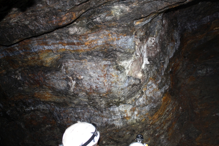
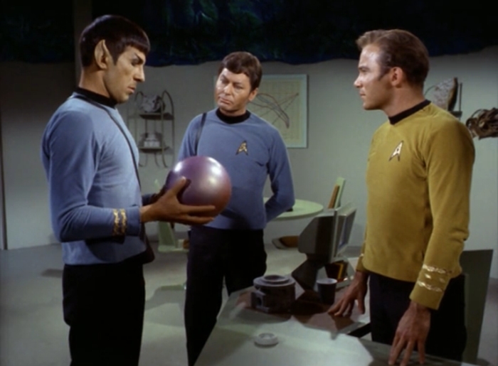
The mining colony in the episode was successfully operating for over fifty years but after the miners opened up a new level deep within the planet suddenly a monster started to attack and kill people. The Enterprise sends Kirk, Spock and McCoy for help. Spock during a meeting with the chief engineer Vanderberg, the administrative head of the mine, notes a strange sample in the office:

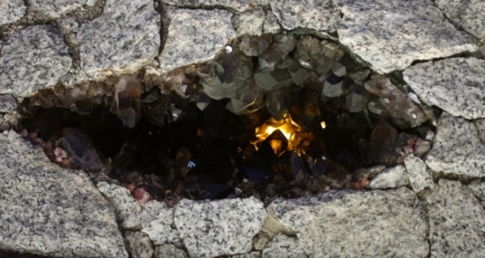
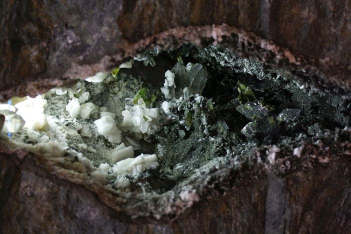
“It’s a silicon nodule. There are a millions of them are down there. No commercial value.”

“But a geological oddity, to say the least. Pure silicon?”

“A few trace elements. Look, we didn’t call you here so you could collect rocks.”

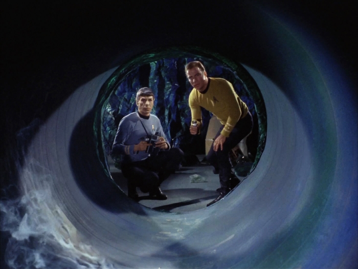
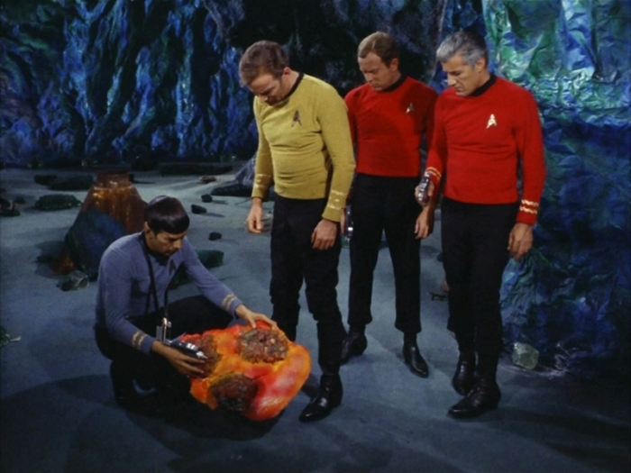
Later Spock and Kirk are able to injure the supposed monster and recover what seems to be living tissue, however, a close inspection reveals the tissue to be “fibrous asbestos, a mineral.” Asbestos is indeed a silicate mineral, which is found as aggregates of thin fibrous crystals on Earth.

Byssolithe, a type of silicate, forms fibrous crystals.

After this discovery Spock speculates that the supposed monster is an alien life-form, not based on carbon compounds as on Earth, but on silicon. The strange silicon nodules destroyed by the clueless miners are eggs and the creature was just defending her children. After Spock joins with the mind of the creature a peaceful agreement is found between the miners and the alien. The miners will not hurt or kill the creatures and the creatures will allow the miners to use their tunnels to mine the deeper pergium-rich layers of the planet (and so become rich). The Horta, as this alien is named in the series, use a sort of hot acid to melt their tunnels in the solid rocks.

The silicon-based life-form as depicted in Star Trek is surprisingly scientifically accurate. In life as we know it only ten elements play a mayor role. Carbon is one of the most important elements, followed by oxygen, nitrogen, hydrogen, potassium, calcium, magnesium, iron, phosphorus and sulfur. Carbon is common in the universe but relatively rare on Earth. Strangely silicon is quite common in Earth’s rock, but plays only an insignificant role in biological processes. Some microorganisms, like radiolarians and diatoms, use silaffins and silica-hydrogels to build their tiny shells. Siliceous sponges use silicon to support their body by constructing a framework composed of tiny needles of silicon dioxide. However, all those organisms use silicon only to build their skeleton, not in their living tissue or metabolism.

Carbon, despite its relative rarity on Earth, has some important advantages for life on Earth. It can form stable and complex macromolecules within the range of terrestrial temperatures. Living bacteria are found on Earth in 240°F hot springs and on frozen rocks of Antarctica, thriving at -60°F . Atomic bounds between carbon-carbon, carbon-oxygen and carbon-hydrogen atoms are strong and the formed molecules are soluble and stable in water. Water is so important for carbon-based life as it´s a perfect environment for molecules to react with each other, resulting in a life-sustaining metabolism. Silicon, like carbon, can form stable bounds with itself and other elements like carbon, nitrogen, phosphorus, oxygen, sulfur and many metals. Such silanes can form sheets, chains, tubes and even complex three-dimensional frameworks. In theory silanes could be combined to form organelles of a living cell and even reactive molecules sustaining an alternative metabolism.

That said, silicon shows a very strong affinity to oxygen and hydrogen. On Earth the tissue of a silicon-based life-form would slowly react with the oxygen of the air and the hydrogen in the water, corroding and killing the creature. Doctor McCoy even mentions this fact in the episode. However, Spock notes that the creature comes from within the planet, where suitable conditions for silicon-based life might exist.

Silicon-life would need an oxygen-free atmosphere, an environment with no water and an alternative liquid for its metabolism. Possible alternative solvents that may work include liquid methane and ethane, but also sulfuric and hydrocyanic acid.  The acid could explain the (fictional) ability of the Horta to “digest rock” and to “tunnel” so quickly “for nourishment” through the planet. As such compounds are unstable at higher temperatures, the silicon-based life-form would best thrive in a very cold environment.

Could such life really exist? Unfortunately we don’t know for sure and the Horta is never again mentioned in the original series. Maybe this question will be answered by future generations, when humanity encounters life, but not as we know it. How will we react? In “The Devil in the Dark,” the first response was fear and hate, in the end overcome by knowledge and emphaty – a message in the best tradition of Star Trek.

Geology and Alpine-Type Fissures

Swiss professor of philosophy Horace-Bénédict de Saussure (1740-1799) was one of the first naturalists to collect observations and measurements in the field. He did so by traveling the Alps and climbing various mountains, among others the Mont Blanc, with 4.810 meter the highest peak of the Alps. During his ascent, he recorded the physiological reactions of his body to the increased elevation, measured air temperature and described the rocks which compose the mountain. One of De Saussure’s guides onto the peak of Mont Blanc was Jacques Balmat, a local chamois hunter and Strahler. A strahler is a crystal seeker, so named after the Strahlen, the shining quartz crystals. The granite of Mont Blanc is famous for its Alpine-type fissures, hosting sometimes spectacular crystals.

The crystal seeker Jacques Balmat, painting by Henry Lévèque.
Reconstruction of an Alpine fissure in Mont Blanc granite, with quartz, flourite and chlorite crystals.

Most common are gash fractures formed during the Alpine orogenesis some 25 to 15 million years ago. Below 500°C rocks like gneiss, schist and amphibolite tend to react brittle to tectonic deformation. Permeable to circulating fluids, in the open fissures and at temperatures of 600 to 100°C crystals will start to grow.

Kluft – an Alpine-type fissure in the field. from “Mineralklüfte und Strahler der Surselva” by Flurin Maissen (1950). A stiff layer will tend to deform, flattened and stretched to the point that it “necked”, opening a gash fracture between boudins. Thin layers will wrap around this point, partially forming quartz veins. More deformed, the layers will tend to weather more easily.

Almost 80% of the Alpine-type minerals comprise feldspar, chlorite, calcite, and quartz. Typical Alpine-type minerals are actinolite, apatite, dolomite, epidote, flourite, hematite, titanite, rutile and zeolithe – more than 140 minerals are known from Alpine-type fissures found in the Eastern Alps.

Alpine-type fissure in greenschist with a typical mineral paragenesis of adularia , quartz and chlorite.

De Saussure’s son – Nicolas Théodore de Saussure – will in 1792 name the mineral dolomite, giving the Dolomites their modern name.

Auf der Suche nach Erzadern in den Alpen

» Vermittelst seines bei sich habenden Perg Geists das Perg Männlein beschwören, Unnd aus Irrer Anntworth Clüfft und Geng, im Gebürge erfahrn … «

Beschreibung eines gewissen Hanns Aufinnger, der um 1607 behauptetet, mittels eines Wurzelmännchens mit den Berggeistern in Kontakt treten zu können und so Erzadern im Berg aufzuspüren.
Konkordante Erzlager in Paragneise im Bergbau Schneeberg. Anthophyllit, strahlig, braun- beige, überkrustet und verwachsen mit Zinkblende und Bleiglanz.

Im späten Mittelalter und der frühen Neuzeit erlebte der Bergbau in den Alpen eine Blütezeit. Bevor ein Bergwerk aber gegründet werden kann, muss zunächst mal das erzhaltige Gestein gefunden werden. Die damaligen Prospektionsmethoden wurden erstmals durch Georgius Agricola in seinem „De re metallica libri XII“ (1556), eine systematische Darstellung des damaligen Berg- und Hüttenwesens, die er gemeinsam mit dem Bergmann Blasius Weffringer aus Joachimsthal veröffentlichte, besprochen und dargestellt. Diese alte Prospektionsmethode wurde von BREWEL & GSTREIN 1999 als Limonitdiagnostik zusammengefasst.

Der Prospektor sollte auf bestimmte Merkmale im Gelände achten, darunter auch Verfärbungen und Verwitterung von Gesteinen, wie z.B. Limonit (braun-gelblich gefärbtes Eisenoxid und -hydroxid das oft Erzgestein überkrustet, daher der Name Limonitdiagnostik). Zauberhafte Utensilien wie der Bergspiegel, mit denen Sagengestalten wie die Venedigermandln angeblich in den Berg hineinschauen konnten, beruhen vielleicht auf die Fähigkeiten der Prospektoren, aufgrund Verfärbungen oder Strukturen an einer (glatten) Fels- oder Bergwand die Erzadern zu finden.

Bestimmte Pflanzen oder Pflanzenassozationen, die tolerant gegenüber Schwermetallen im Boden sind, können auf Erzgestein im Untergrund hinweisen. Gleiches gilt für Krüppelwuchs, wenn zu hohe Schwermetallkonzentration zu Wachstumsstörungen oder das Absterben von Bäumen führen.

» Schließlich muß man auf die Bäume achten, deren Blätter im Frühling bläulich oder bleifarben sind, deren Zweigspitzen vornehmlich schwärzlich oder sonst unnatürlich gefärbt sind … auch wächst auf einer Linie, in der sich ein Gang erstreckt, ein gewisses Kraut oder eine gewisse Pilzart … dies sind die Hilfsmittel der Natur, durch die Gänge gefunden werden. «

Seit jeher schürfen die Menschen nach den Schätzen der Erde und versprechen sich Reichtum und Glück. Generationen von Knappen und Bergleuten gruben tiefe Stollen in die Berge auf der Suche nach Edelmetallen und Erzgestein. Noch heute prägen Abraumhalden die Hochebenen, die von Erzpflanzen besiedelt werden, wie hier in Ridnaun durch das Alpenleinkraut (Linaria alpina).
Erzflechte (Lecidea silacea) auf erzhöffigen Prasinit.

Verwitterungsresistente Gesteine die Erz enthalten, wie z.B. Dolomit, können als Härtlinge in der Landschaft auffällige Kuppen bilden. Die Stelle, an der eine Erzader an die Oberfläche kommt, nennt der Bergmann Ausbiss oder aufgrund der rostigen Färbung auch Eiserner Hut. Mittels Lesesteinkartierung in Bächen oder in Schutthalden verfolgt man umgelagertes Geröll das letztendlich zum oberflächlichen Ausbiss der Erzadern führt. Ebenso bewog den Bergmann eine bestimmte Ausbildung eines Gesteins oder eine natürliche Auflockerungszone zum Schürfen, die dadurch den Vortrieb in den Berg wesentlich erleichterte.

Vermutlich mittelalterlicher Probeschurf im Bergbaugebiet Röttal, Gemeindegebiet Prettau.

Auffällig braune, rötliche oder grünliche Ausfällungen in Bächen, oder der metallische Geschmack von Quellen zeigen gelöste Metalle im Grundwasser an. In moorigen Bereichen flockt Eisen bevorzugt aus dem Wasser aus, und bildet rötliche Ablagerungen von Rasenerze zwischen der Vegetation.

Manche Beobachtungen können nur zu bestimmten Jahreszeiten gemacht werden. Die Verwitterung und Oxidation von Erzen (z.B. Pyrit) im Untergrund kann zu einer geringen Wärmeentwicklung führen, die an der Oberfläche abstrahlt. An solchen Stellen findet man im Winter kein Eis und auch der Schnee bleibt im Frühjahr nicht so lange liegen.

Literatur:

  • KOFLER, H. (2012): Silber und Blei – Der Bergbau im raum Sterzing im 15. und 16. Jahrhundert. Berenkamp Verlag: 196
  • MAIR, V.; VAVTAR, F.; SCHÖLZHORN, H. & SCHÖLZHORN, D. (2007): Der Blei-Zink-Erzbergbau am Schneeberg, Südtirol. Mitt. Österr. Miner. Ges. Bd. 153: 145-180
  • PALME, R.; GSTREIN, P. & INGENHAEF, F. (2013): Schwazer Silber – Auf den Spuren der Schwazer Silberknappen. Berenkamp Verlag: 128
  • PUNZ, W. et al. (1994): Pflanzenökologische Befunde vom Bergbaugebiet Schneeberg/Monteneve in Passeier (Südtirol/I): 67-81

Lake Alleghe

The lake of Alleghe in the Cordévole Valley formed at 7:02 in the morning of January 11, 1771. That day a river flowing through the valley became dammed by a landslide coming from the mountain Piz.

The valley of Cordévole with the village and lake of Alleghe, on the left of the mountain Piz the scar of the landslide is barely visible in the forest, in the background the Civetta (3.220m).

The Alps-traveler and naturalist Belsazar Hacquet (1739-1815) remembers a visit to the lake in 1780:

The river Cordévole became my guide, by following him I would find the valley of Cadore. However, just after some hundred steps the river was flowing in a large lake, existing here only for the last nine years. I walked around in eastern direction, leaving the villages of Sternade and Saviner behind me, until I arrived at the base of the mountain of Piz. First the lake was narrow, only near Saviner it became more than 100 Venetian fathom [an old length unit used in the mining industry of these times, one fathom ca. 1,8 meter] wide and more than thirty deep.

The last mentioned village once was situated on a hill, and in the valley there were four smaller villages …[]… flooded by the lake, …[]… [the village] Marin, was buried with the village of Riete beneath the collapsing mountain of Piz, the last described village located previously on the top of the mountain.

Standing on the top of the mountain, I immediately noted that the mountain has a volcano on top of it, and it was possible to see how deep [its volcanic dikes] went. After the mountain collapsed, it could be seen that its base was composed of limestone, build up by mighty layers, dipping from west to east with a 45 degrees angle. The [slip] surface of the landslide is so smooth, that a man has difficulties to climb on it to the top of the mountain.

The strange notion by Hacquet of an active volcano in the Dolomites is based maybe on his discovery of volcanic rocks in the area, however – as we today know – these volcanic deposits are more than 235-million-years-old. At the time of Hacquet’s geologic investigation, volcanic forces were believed to cause strong and sudden movements of Earth, explaining sudden disasters like a landslide.

The landslide of Alleghe killed 48 people and destroyed parts of the village of Riete and some farms. Water levels in the landslide-lake continued to rise over the next weeks, inundating the village of Peron. Only in February 1771, a new outflow formed, stabilizing water levels and creating the modern lake.

Historic depiction of the landslide-lake in the “Atlas Tyrolensis” of 1774 by Peter Anich and Blasius Hueber. Note the boulders on the southern shore of the lake. Anich and Hueber were the first cartographers to use signatures to display geomorphologic features -like landslides – in their maps.