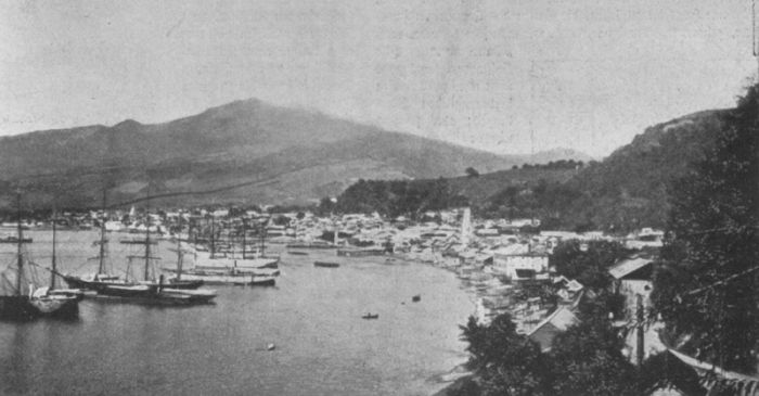
May 8, 1902, began as a sunny day in Martinique, an island in the Caribbean, with only a column of steam rising above Mount Pelée. When the volcano suddenly exploded.
The first rescuers arrived on the site twelve days after the eruption, accompanied by British, French and American geologists. In the city of St. Pierre, almost all of the buildings had been destroyed and an estimated 20.000-40.000 people killed.
» I looked back and the whole side of the mountain, facing towards the town, seemed to open and topple down on the screaming people. I was burned by stones and ashes …, but I got to the cave «
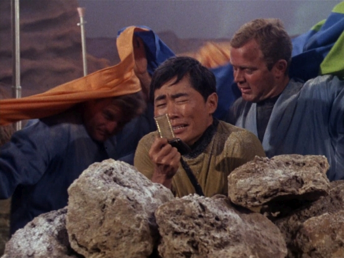
Havivra Da Ifrile, a girl who survived the destruction of St. Pierre hiding inside a cave near the shore.
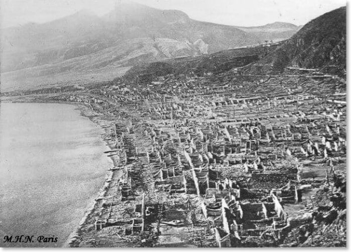
Geologist Edmund Hovey of the American Museum of Natural History, among the first to arrive to the destroyed city, noted that “In many places the limit [of the devastation] passes single trees, one side is dark and burned, the other green as if an eruption never happened.” A lava flow or landslide could not explain the burned trees nor could it explain the sharp boundary between the destroyed and untouched areas.
Two months later, geologists Tempest Anderson and John S. Flett of the Royal Society of London survived a smaller eruption of Mount Pelée.
» The cloud had a spherical form and resembled rounded protuberances amplifying and doubling with terrifying energy. They extended to the sea, in our direction, boiling and changing shape at every moment. It didn’t spread laterally. It didn’t rise up in the atmosphere, but it descended on the sea as a turbulent mass… «
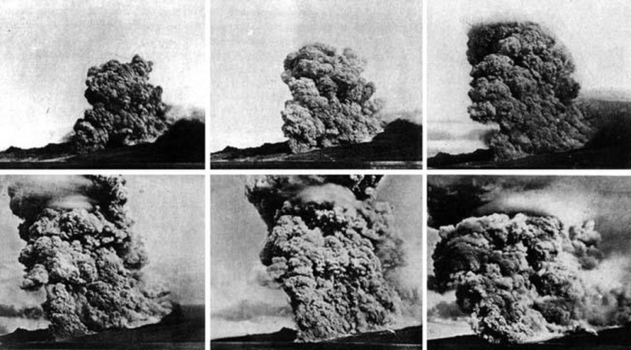

For the very first time geologists observed a deadly nueé ardente – an incandescent cloud or glowing avalanche as the phenomenon was first named by French volcanologist Alfred Lacroix in 1904. A nueé ardente, in modern literature referred to as a pyroclastic density current, is a mixture of volcanic material and hot gases. Because its density is greater than air, it sinks downward, flowing like an avalanche along the slopes of a volcano. Pyroclastic flows can originate from the collapse of the eruption column, from a lateral blast or from the partial collapse of a volcano.
Researchers were able to estimate temperatures inside the pyroclastic flow that destroyed St. Pierre based on the observation that bottles melted (glass melts at ~700°C), but copper tubes were not deformed (copper melts at 1.100°C). The geologists, therefore, concluded that temperatures of a pyroclastic flows can range between 700 to 1.000°C. The high temperatures inside a pyroclastic flow also explain why so many people perished in St. Pierre. The heat was so intense that it instantly burnt the outer layers of skin and flesh. As the flesh shrinks due to the loss of water, the inner organs were squeezed out from their cavities. Even those not hit directly by the pyroclastic flow weren’t spared. Inhaling the still 300°C hot gases, their lungs quickly filled with liquid, drowning them.
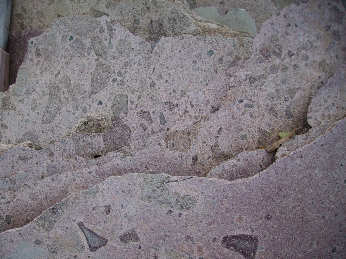
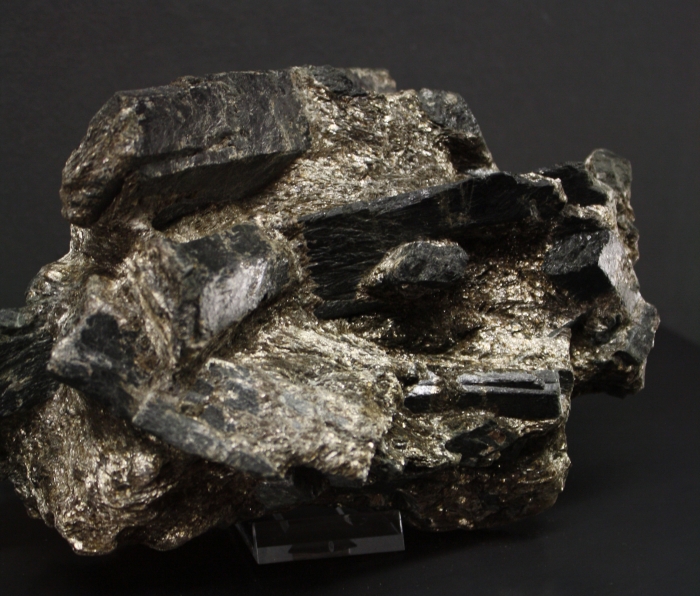
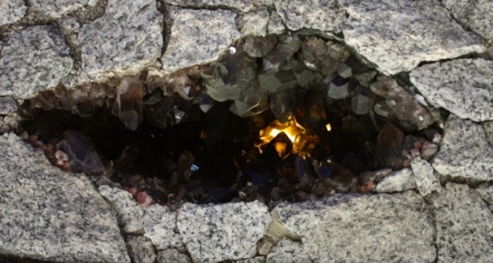
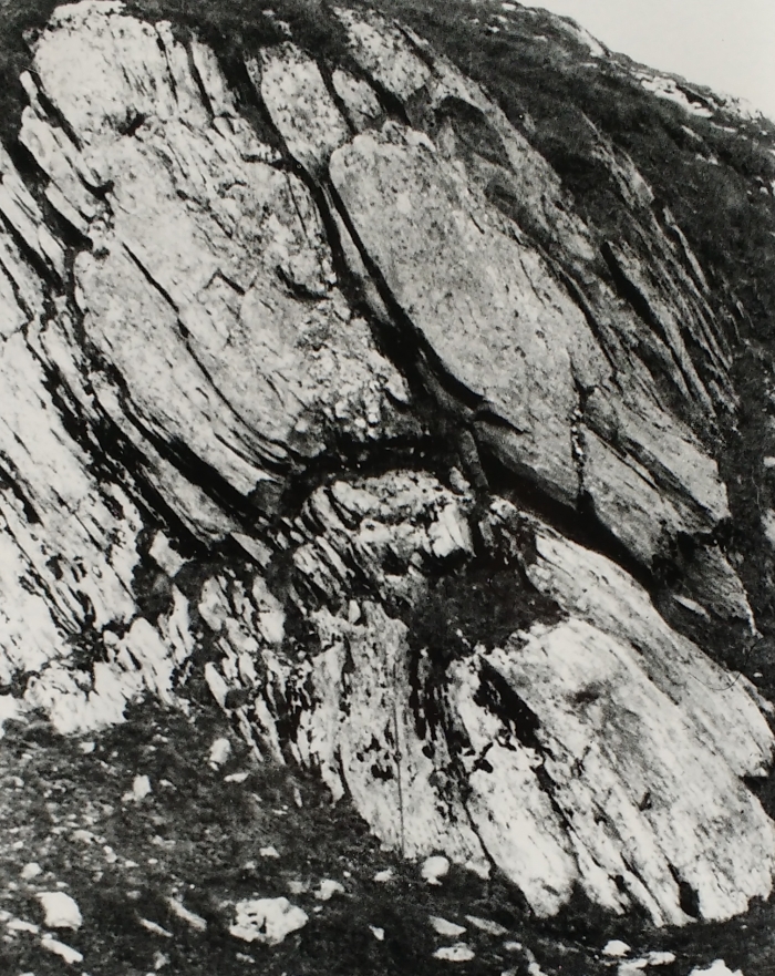
The photo shows a 200 million-year-old ignimbrite – a name used for lithified deposits of a pyroclastic flow and derived from the Latin word for fire – of the Athesian Volcanic Group. Some of the larger clasts in the photo show an outer rim, indicating that the temperature inside the pyroclastic flow was high enough to alter the mineralogical composition of the rock. The larger rocks are embedded into a matrix of volcanic ash. Pyroclastic flows – a mixture of rocks, overheated gases and vapour – are able to transport even large boulders at a speed of 160km/h. As a result, the impacting mass destroys everything in its path, as happened to the town of St. Pierre.
References:
- MORELLI, C.; BARGOSSI, G.M.; MAIR, V.; MAROCCHI, M. & MORETTI, A. (2007): The lower Permian volcanics along the Etsch Valley from Meran to Auer (Bozen). Mitt. Österr. Minera. Ges. 153: 1-25
- VOLKMAR, S. & VOLKMAR, M. (2005): Introduction to the geology of South Tyrol. Ufficio geologia e prove materiali – Provincia Autonoma di Bolzano-Alto Adige: 80